Разделы презентаций
- Разное
- Английский язык
- Астрономия
- Алгебра
- Биология
- География
- Геометрия
- Детские презентации
- Информатика
- История
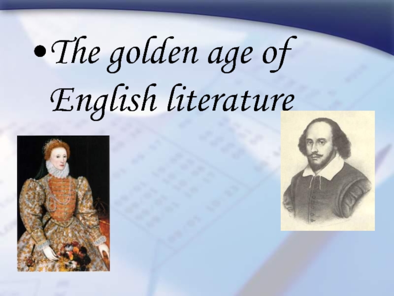
- Литература
- Математика
- Медицина
- Менеджмент
- Музыка
- МХК
- Немецкий язык
- ОБЖ
- Обществознание
- Окружающий мир
- Педагогика
- Русский язык
- Технология
- Физика
- Философия
- Химия
- Шаблоны, картинки для презентаций
- Экология
- Экономика
- Юриспруденция
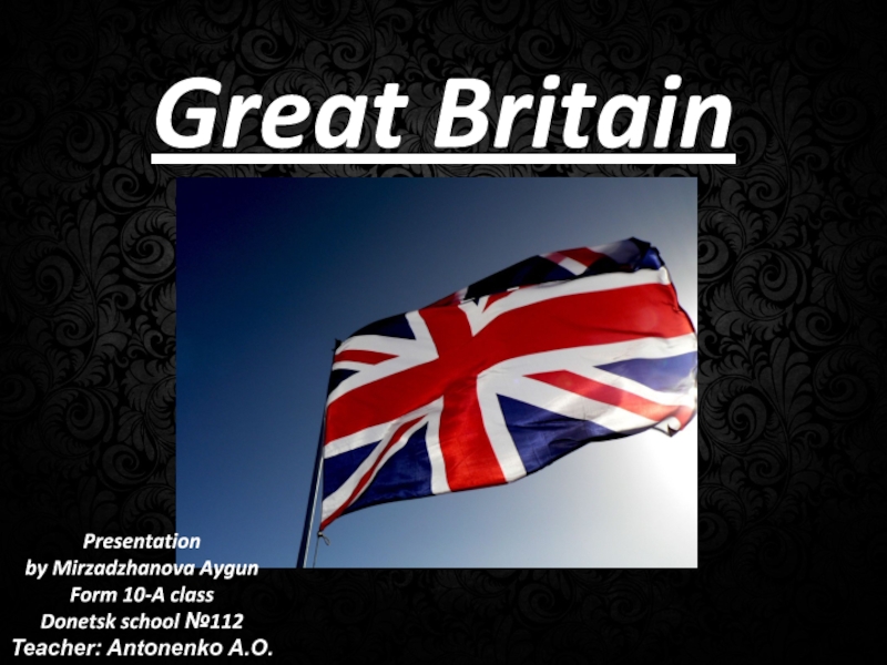
The United Kingdom Of Great Britain and Northern Ireland. Prepared by Alissa Meznikova
Содержание
- 1. The United Kingdom Of Great Britain and Northern Ireland. Prepared by Alissa Meznikova
- 2. Geography of Great Britain
- 3. Geographical InformationLocation: Western Europe, islands including the
- 4. Geographical InformationTerrain: mostly rugged hills and low
- 5. The United Kingdom of
- 6. Climate temperate; moderated by prevailing southwest winds over
- 7. Great Britainlies near vital North Atlantic sea
- 8. Geographically, the island is marked by
- 9. The north and west of
- 10. There are a lot of
- 11. The UK consist of 4 countries: England, Scotland, Wales and Northern Ireland.
- 12. England
- 13. Scotland
- 14. Wales
- 15. Northern Irelsnd
- 16. FLAGSThe UKScotlandWalesNorthern IrelandEnglandFlags
- 17. the symbol of England is the red
- 18. THE CAPITAL OF ENGLAND IS LONDONCapitals
- 19. THE CAPITAL OF SCOTLAND IS EDINBURGH
- 20. THE CAPITAL OF WALES IS CARDIFF
- 21. THE CAPITAL OF NORTHERN IRELAND IS BELFAST
- 22. THE CAPITAL OF THE UK IS
- 23. Слайд 23
- 24. Yes, this is Great Britain
- 25. The End
- 26. Скачать презентанцию
Geography of Great Britain
Слайды и текст этой презентации


Слайд 3Geographical Information
Location: Western Europe, islands including the northern one-sixth of
the island of Ireland between the North Atlantic Ocean and
the North Sea, northwest of FranceGeographic coordinates: 54 00 N, 2 00 W
Map references: Europe
Area: total: 244,820 sq km
land: 241,590 sq km
water: 3,230 sq km
note: includes Rockall and Shetland Islands
Area - comparative: slightly smaller than Oregon
Land boundaries: total: 360 km
border countries: Ireland 360 km
Coastline: 12,429 km
Maritime claims: territorial sea: 12 nm
exclusive fishing zone: 200 nm
Climate: temperate; moderated by prevailing southwest winds over the North Atlantic Current; more than one-half of the days are overcast

Слайд 4Geographical Information
Terrain: mostly rugged hills and low mountains; level to
rolling plains in east and southeast
Elevation extremes: lowest point: The
Fens -4 mhighest point: Ben Nevis 1,343 m
Natural resources: coal, petroleum, natural gas, iron ore, lead, zinc, gold, tin, limestone, salt, clay, chalk, gypsum, potash, silica sand, slate, arable land
Land use: arable land: 23.46%
permanent crops: 0.21%
other: 76.33% (2001)
Natural hazards: winter windstorms; floods
Geography - note: lies near vital North Atlantic sea lanes; only 35 km from France and now linked by tunnel under the English Channel; because of heavily indented coastline, no location is more than 125 km from tidal waters
Population: 60,441,457 (July 2005 est.)

Слайд 5 The United Kingdom of Great Britain and
Northern Ireland is situated on the British Isles. The British
Isles consist of 2 large islands, Great Britain and Ireland, and about 5000 small islands.The British Isles are separated from the European continent by the North Sea and the English Channel. The western coast of Great Britain is washed by the Atlantic Ocean and the Irish Sea.
GREAT BRITAIN
THE ATLANTIC OCEAN
The Irish Sea
the North Sea
the English Channel
Geographical position

Слайд 6Climate
temperate; moderated by prevailing southwest winds over the North Atlantic
Current; more than one-half of the days are overcast

Слайд 7Great Britain
lies near vital North Atlantic sea lanes; only 35
km from France and now linked by tunnel under the
English Channel; because of heavily indented coastline, no location is more than 125 km from tidal waters
Слайд 8 Geographically, the island is marked by low, rolling countryside
in the east and south, while hills and mountains predominate
in the western and northern regions. It is surrounded by over 1,000 smaller islands and islets.
Слайд 9 The north and west of England are mountainous,
but mountains are not very high. BEN NAVIS in Scotland
is the highest mountain (1343 m)Mountains

Слайд 10 There are a lot of rivers in the
UK, but they are not very long.
Rivers
The SEVERN
is the longest river. The THAMES is the deepest and the most important one.


Слайд 17the symbol of England is the red rose
the symbol of
Wales is the daffodil
the symbol of Scotland is the thistle
The
symbol of Nothern Ireland is the shamrockSymbols


Теги