Разделы презентаций
- Разное
- Английский язык
- Астрономия
- Алгебра
- Биология
- География
- Геометрия
- Детские презентации
- Информатика
- История
- Литература
- Математика
- Медицина
- Менеджмент
- Музыка
- МХК
- Немецкий язык
- ОБЖ
- Обществознание
- Окружающий мир
- Педагогика
- Русский язык
- Технология
- Физика
- Философия
- Химия
- Шаблоны, картинки для презентаций
- Экология
- Экономика
- Юриспруденция
English-speaking countries
Содержание
- 1. English-speaking countries
- 2. English-speaking countries:Great BritainUSACanada AustraliaNew Zealand
- 3. Great Britain The British Isles lie in the
- 4. Great BritainArea: 229.848 sq. kms.Population: about 61
- 5. Great BritainOne of the oldest flag in
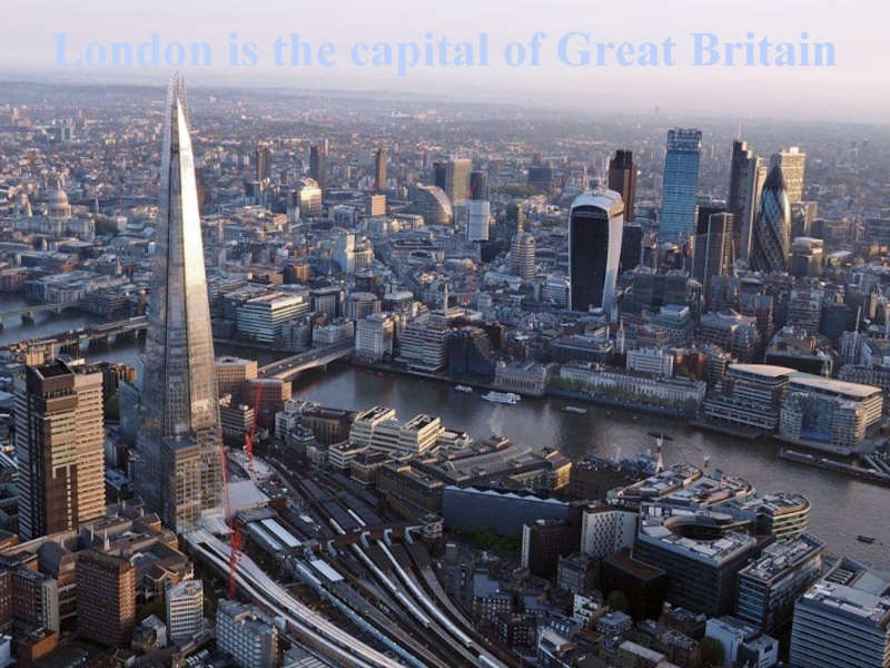
- 6. London is the capital of Great Britain
- 7. LondonLondon is political, economic and cultural centre.
- 8. The term «United States», when used in
- 9. USAArea: 9.629.091 sq. kms (total)Population: about 321.163.157
- 10. USAGreat Seal of the United States is
- 11. USAThe American flag is called the Stars
- 12. Washington is the capital of the USA
- 13. WashingtonCapitol Hill is the largest residential historic
- 14. CANADACanada is a country, consisting of ten
- 15. CANADAArea: 9.984.670 sq. kmsPopulation: about 35.749.600 people
- 16. CANADAThe National Flag of Canada, also known
- 17. Ottawa is the capital of Canada
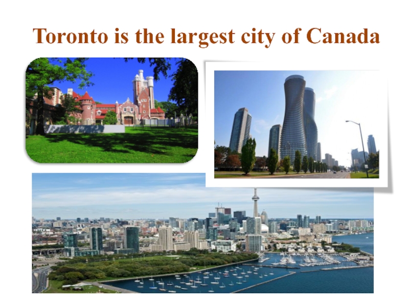
- 18. Toronto is the largest city of Canada
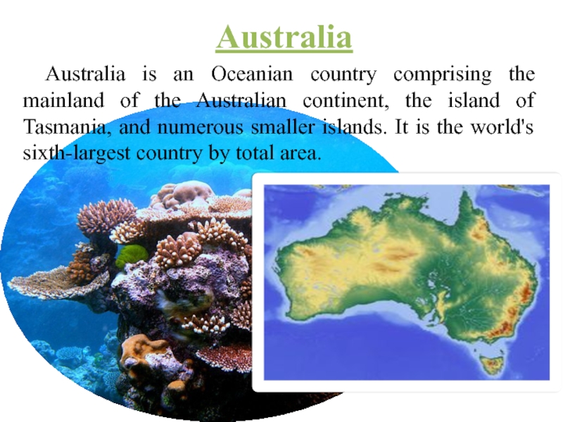
- 19. AustraliaAustralia is an Oceanian country comprising the
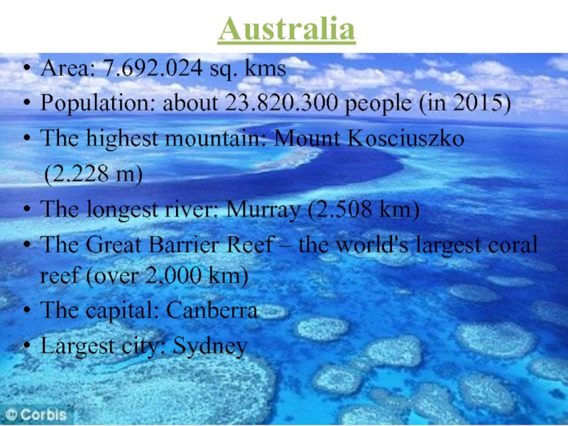
- 20. AustraliaArea: 7.692.024 sq. kmsPopulation: about 23.820.300 people
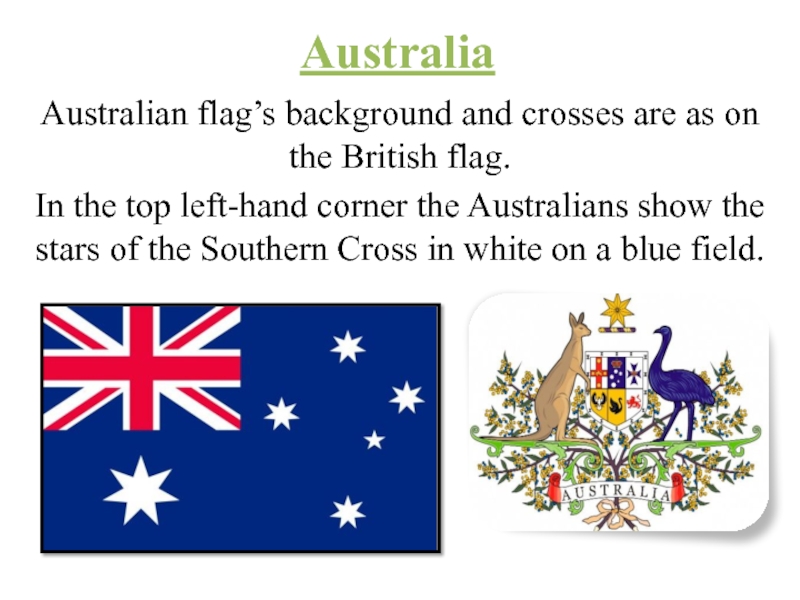
- 21. AustraliaAustralian flag’s background and crosses are as
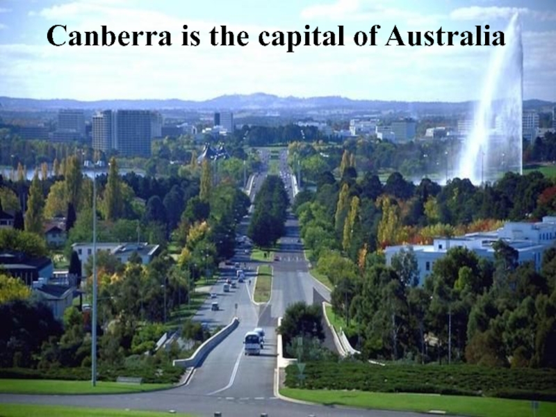
- 22. Canberra is the capital of Australia
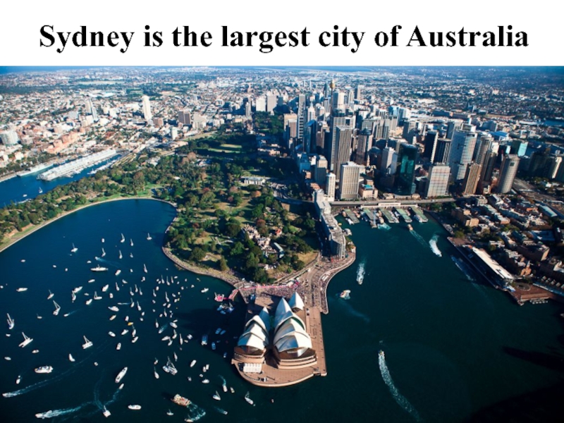
- 23. Sydney is the largest city of Australia
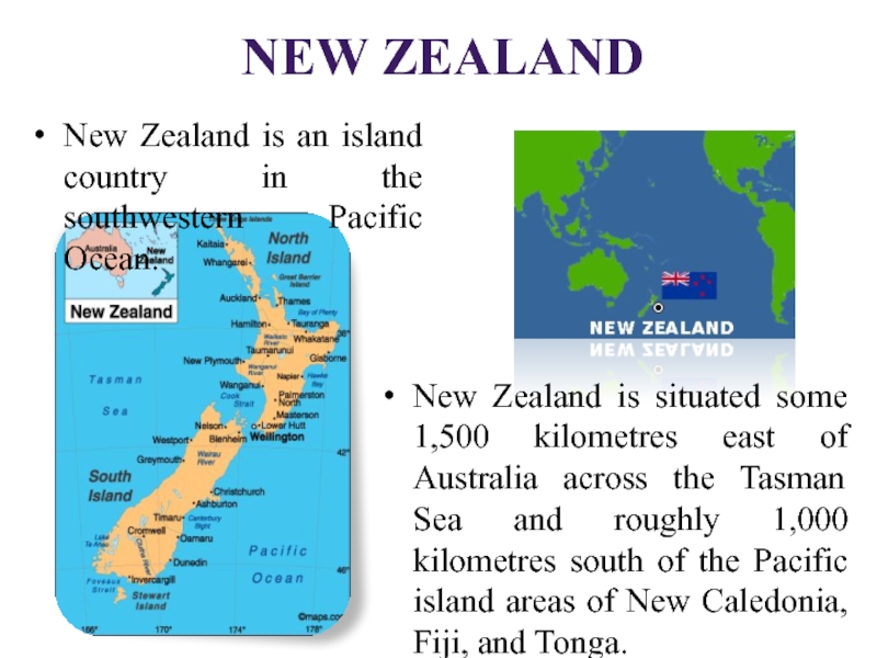
- 24. New ZealandNew Zealand is an island country
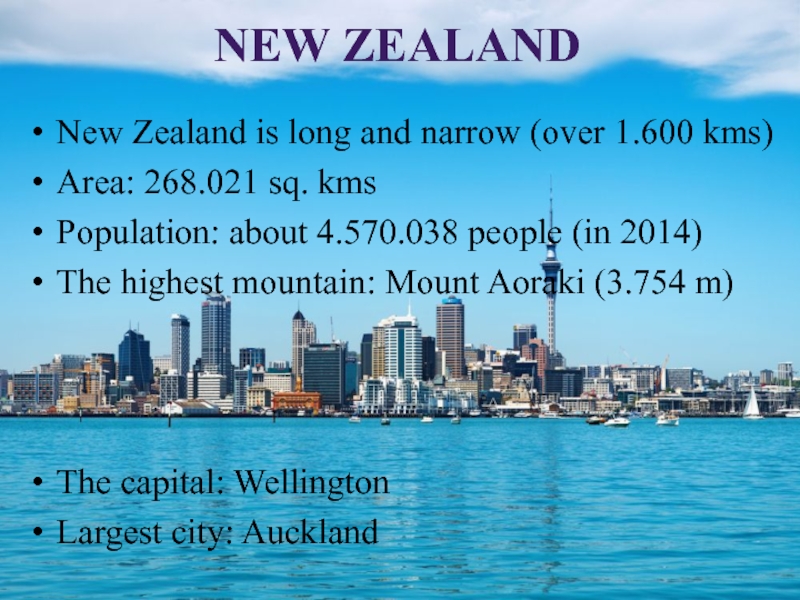
- 25. New ZealandNew Zealand is long and narrow
- 26. New ZealandThe stars of the Southern Cross
- 27. Wellington is the capital of New Zealand
- 28. Auckland is the largest city of New Zealand
- 29. Источники иллюстрацийСлайд 1. Дети: http://voprosy-pochemu.ru/wp-content/uploads/2014/04/english-language-300x200.jpgСлайд 3. Карта
- 30. Источники иллюстрацийСлайд 10, герб США: http://eamerica.ru/img/pages/symbols/seal/seal.jpg ,
- 31. Источники иллюстрацийСлайд 20. Риф. Австралия: http://i.dailymail.co.uk/i/pix/2009/04/12/article-1169411-046ADD2E000005DC-63_468x286.jpgСлайд 21.
- 32. Слайд 26. Флаг Новой Зеландии: http://ostranah.ru/media/flags/new_zealand_flag.gif , герб: http://ostranah.ru/media/coats_of_arms/new_zealand_coat_of_arms.jpgСлайд 27. Веллингтон: http://www.startupdaily.net/wp-content/uploads/2015/03/Wellington-1024x640.jpgСлайд 28. Окленд: http://allworldtowns.com/data_images/countries/auckland/auckland-02.jpgИсточники иллюстраций
- 33. Источники текстовой информацииСлайд 4. Great Britain: https://en.wikipedia.org/?title=Great_BritainСлайд
- 34. Слайд 14. Канада: https://en.wikipedia.org/wiki/Canada Слайд 15. Канада:
- 35. Thank you for your attention!
- 36. Скачать презентанцию
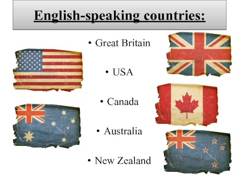
English-speaking countries:Great BritainUSACanada AustraliaNew Zealand
Слайды и текст этой презентации
Слайд 1Конкурс презентаций «Я мыслью улечу к брегам туманным Альбиона» Сообщество взаимопомощи
учителей Pedsovet.su
УВК №3 «Школа-лицей»»Слайд 3Great Britain
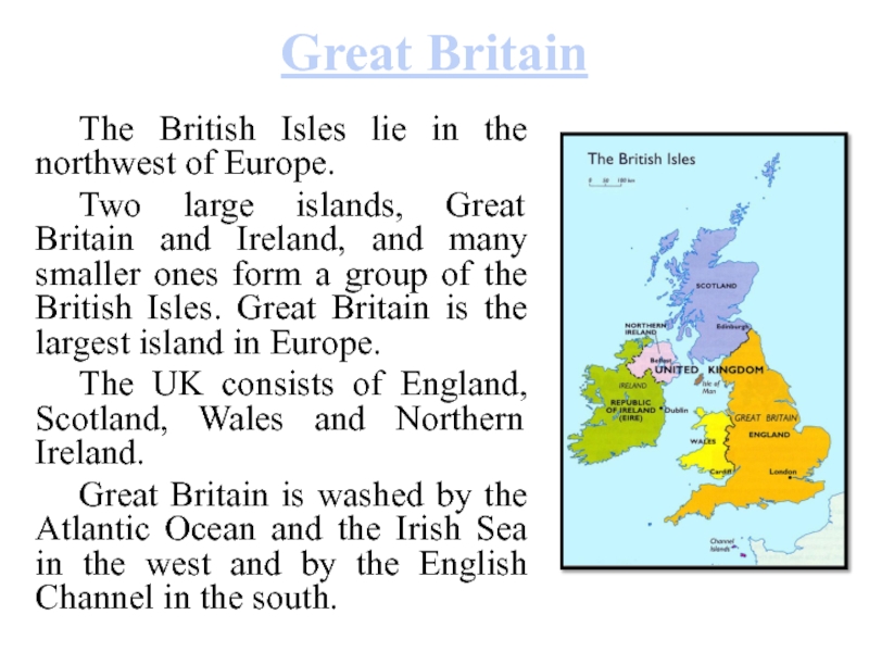
The British Isles lie in the northwest of Europe.
Two
large islands, Great Britain and Ireland, and many smaller ones
form a group of the British Isles. Great Britain is the largest island in Europe.The UK consists of England, Scotland, Wales and Northern Ireland.
Great Britain is washed by the Atlantic Ocean and the Irish Sea in the west and by the English Channel in the south.
Слайд 4Great Britain
Area: 229.848 sq. kms.
Population: about 61 million people (in
2011)
The highest mountain: Ben Nevis (in Scotland)
The longest river: Severn
Climate:
damp and mild: the winter is not very cold and the summer is not very hotThe capital: London
Слайд 5Great Britain
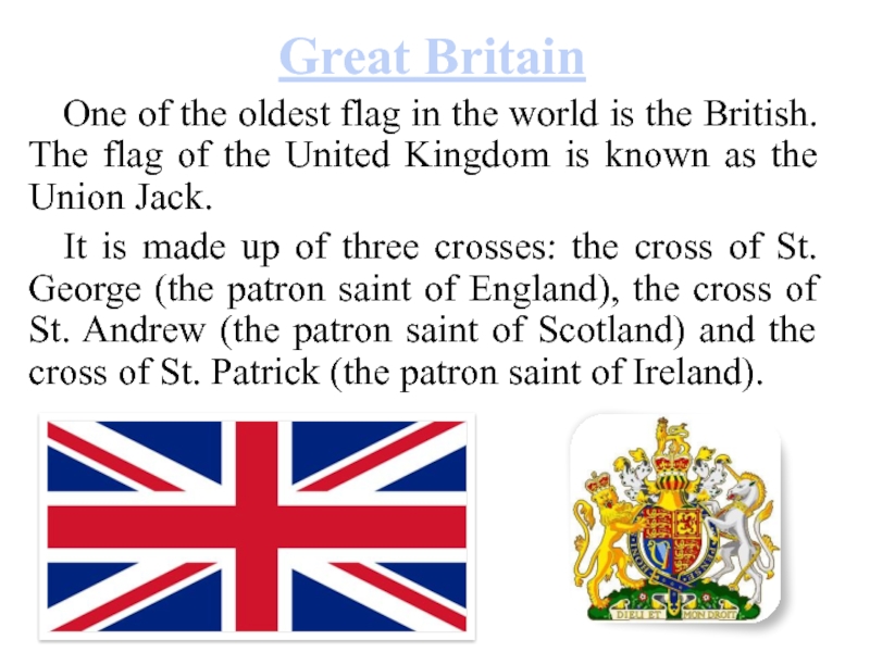
One of the oldest flag in the world is
the British. The flag of the United Kingdom is known
as the Union Jack.It is made up of three crosses: the cross of St. George (the patron saint of England), the cross of St. Andrew (the patron saint of Scotland) and the cross of St. Patrick (the patron saint of Ireland).
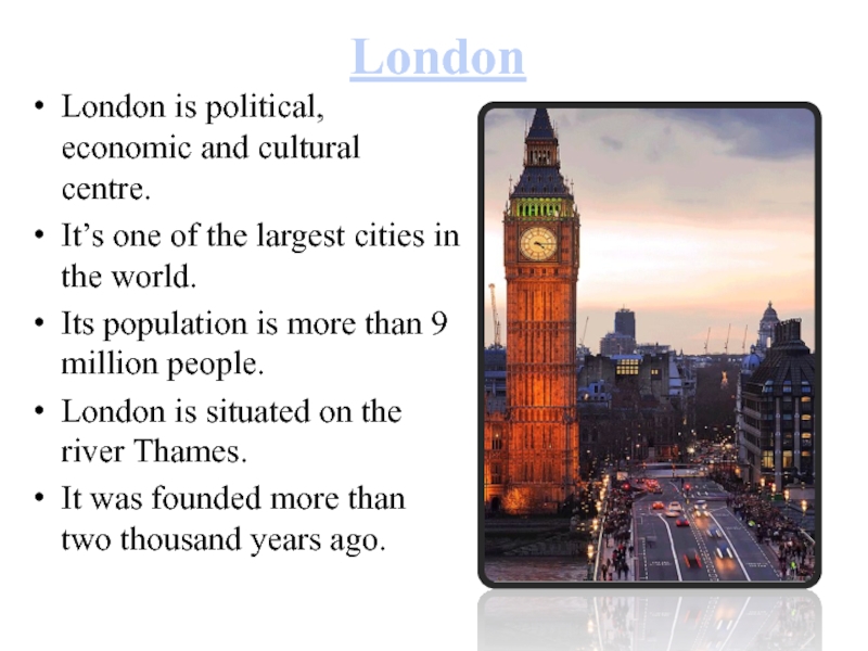
Слайд 7London
London is political, economic and cultural centre.
It’s one of
the largest cities in the world.
Its population is more
than 9 million people. London is situated on the river Thames.
It was founded more than two thousand years ago.
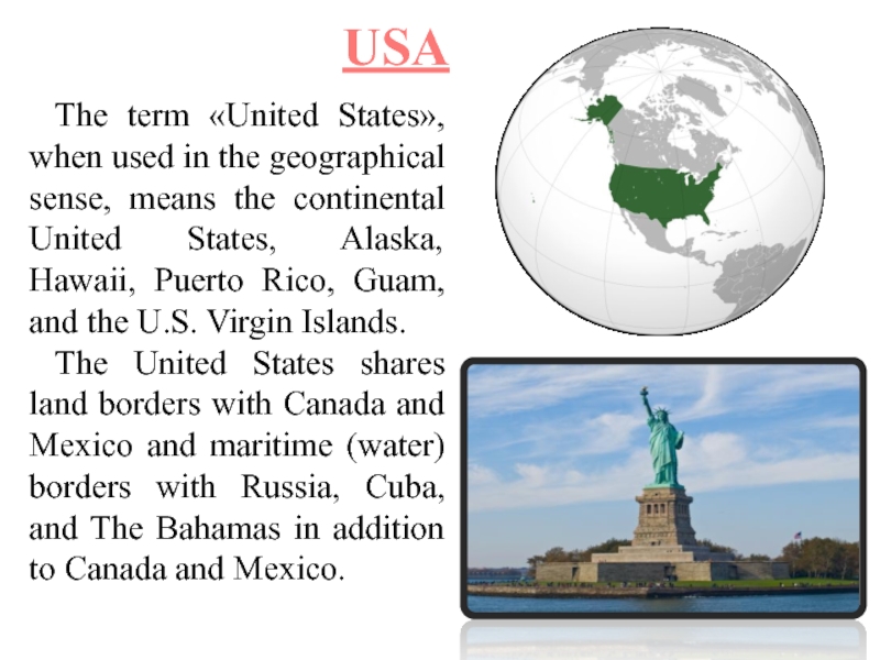
Слайд 8The term «United States», when used in the geographical sense,
means the continental United States, Alaska, Hawaii, Puerto Rico, Guam,
and the U.S. Virgin Islands.The United States shares land borders with Canada and Mexico and maritime (water) borders with Russia, Cuba, and The Bahamas in addition to Canada and Mexico.
USA
Слайд 9USA
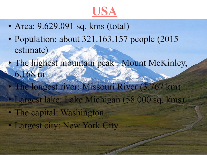
Area: 9.629.091 sq. kms (total)
Population: about 321.163.157 people (2015 estimate)
The
highest mountain peak : Mount McKinley, 6.168 m
The longest river:
Missouri River (3.767 km) Largest lake: Lake Michigan (58.000 sq. kms)
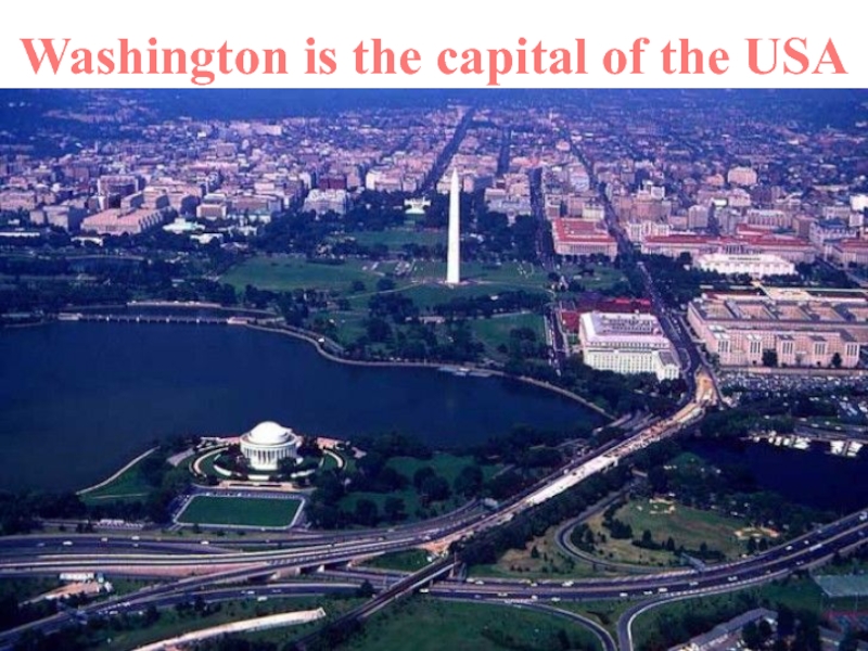
The capital: Washington
Largest city: New York City
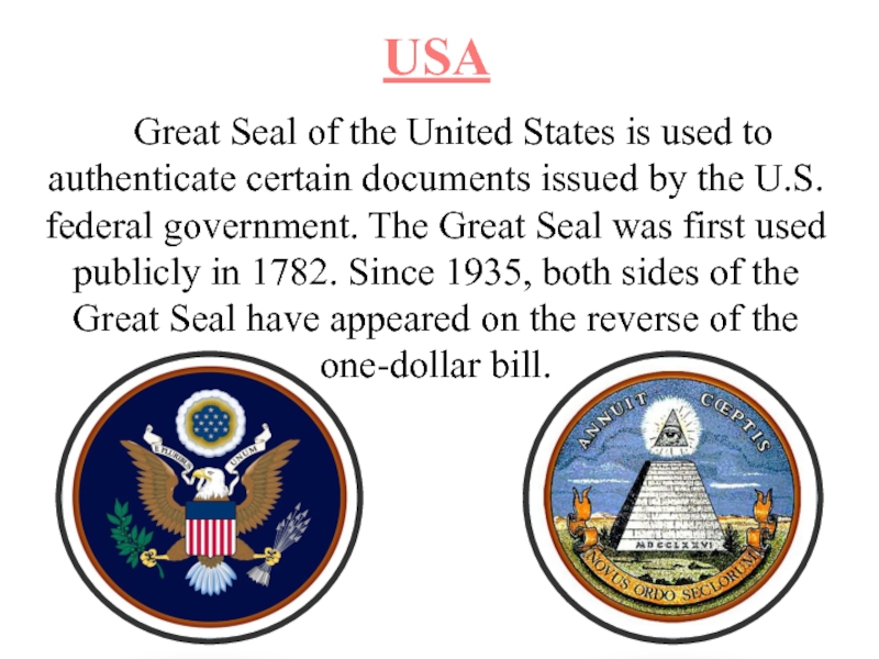
Слайд 10USA
Great Seal of the United States is used to authenticate
certain documents issued by the U.S. federal government. The Great
Seal was first used publicly in 1782. Since 1935, both sides of the Great Seal have appeared on the reverse of the one-dollar bill.Слайд 11USA
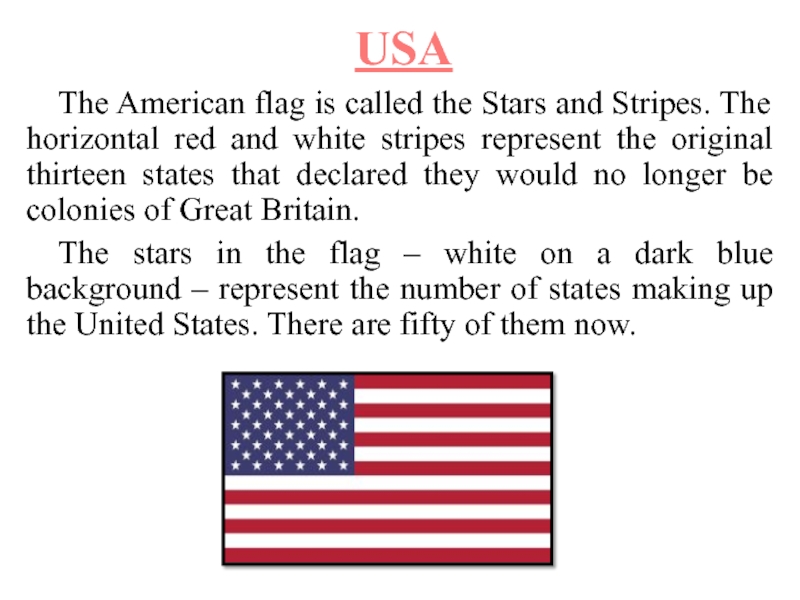
The American flag is called the Stars and Stripes. The
horizontal red and white stripes represent the original thirteen states
that declared they would no longer be colonies of Great Britain.The stars in the flag – white on a dark blue background – represent the number of states making up the United States. There are fifty of them now.
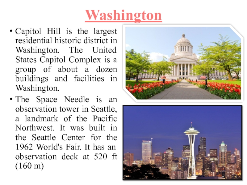
Слайд 13Washington
Capitol Hill is the largest residential historic district in Washington.
The United States Capitol Complex is a group of about
a dozen buildings and facilities in Washington.The Space Needle is an observation tower in Seattle, a landmark of the Pacific Northwest. It was built in the Seattle Center for the 1962 World's Fair. It has an observation deck at 520 ft (160 m)
Слайд 14CANADA
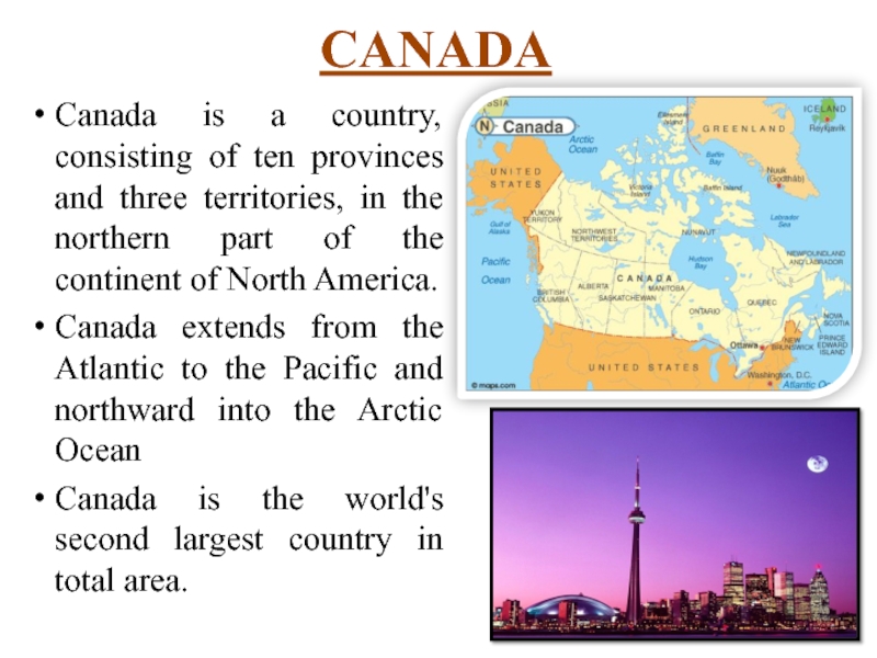
Canada is a country, consisting of ten provinces and three
territories, in the northern part of the continent of North
America.Canada extends from the Atlantic to the Pacific and northward into the Arctic Ocean
Canada is the world's second largest country in total area.
Слайд 15CANADA
Area: 9.984.670 sq. kms
Population: about 35.749.600 people (in 2015)
The highest
mountain: Mount Logan (6.050 m)
The longest river: Mackenzie River (4.241
km) Largest lake: Great Bear Lake (31.153 sq. kms)
Climate: temperate in south to subarctic or arctic in north
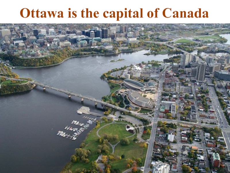
The capital: Ottawa
Largest city: Toronto
Слайд 16CANADA
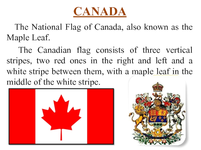
The National Flag of Canada, also known as the Maple
Leaf.
The Canadian flag consists of three vertical stripes, two
red ones in the right and left and a white stripe between them, with a maple leaf in the middle of the white stripe.Слайд 19Australia
Australia is an Oceanian country comprising the mainland of the
Australian continent, the island of Tasmania, and numerous smaller islands.
It is the world's sixth-largest country by total area.Слайд 20Australia
Area: 7.692.024 sq. kms
Population: about 23.820.300 people (in 2015)
The highest
mountain: Mount Kosciuszko
(2.228 m)
The longest river: Murray
(2.508 km) The Great Barrier Reef – the world's largest coral reef (over 2,000 km)
The capital: Canberra
Largest city: Sydney
Слайд 21Australia
Australian flag’s background and crosses are as on the British
flag.
In the top left-hand corner the Australians show the
stars of the Southern Cross in white on a blue field.Слайд 24New Zealand
New Zealand is an island country in the southwestern
Pacific Ocean.
New Zealand is situated some 1,500 kilometres east of
Australia across the Tasman Sea and roughly 1,000 kilometres south of the Pacific island areas of New Caledonia, Fiji, and Tonga.Слайд 25New Zealand
New Zealand is long and narrow (over 1.600 kms)
Area:
268.021 sq. kms
Population: about 4.570.038 people (in 2014)
The highest mountain:
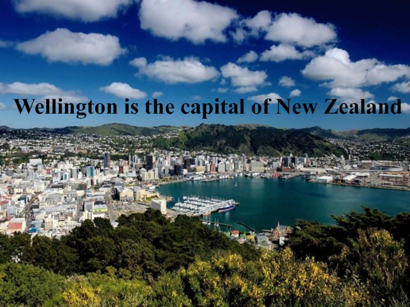
Mount Aoraki (3.754 m)The capital: Wellington
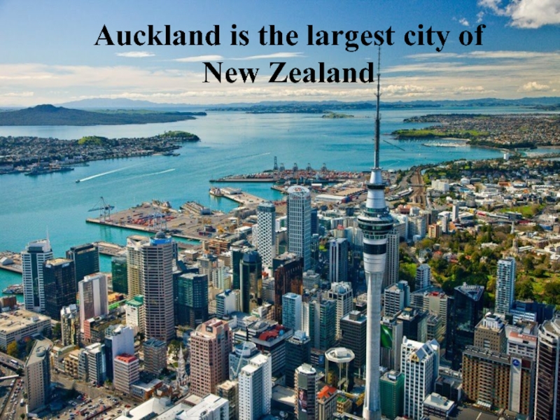
Largest city: Auckland
Слайд 26New Zealand
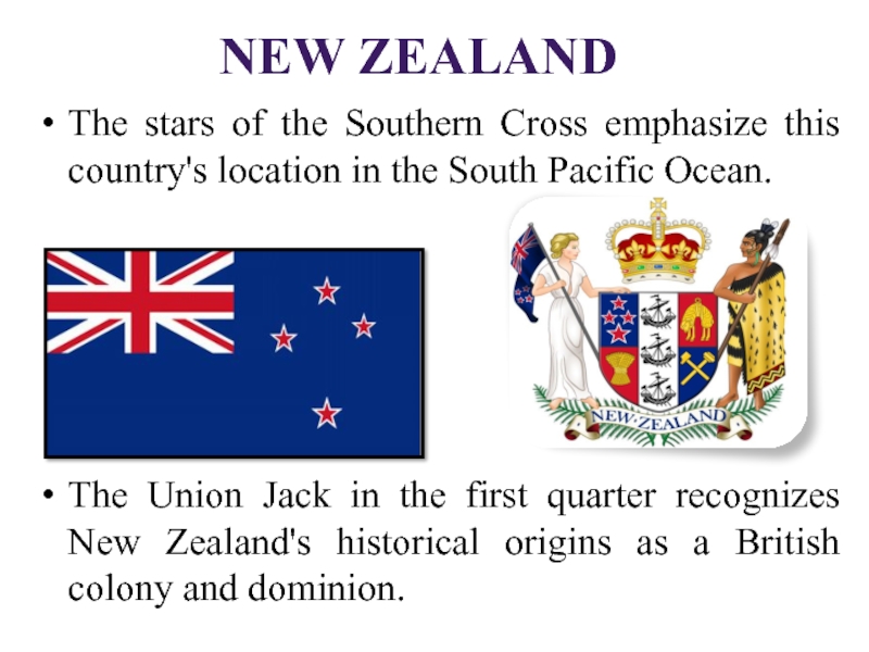
The stars of the Southern Cross emphasize this country's
location in the South Pacific Ocean.
The Union Jack in the
first quarter recognizes New Zealand's historical origins as a British colony and dominion.Слайд 29Источники иллюстраций
Слайд 1. Дети: http://voprosy-pochemu.ru/wp-content/uploads/2014/04/english-language-300x200.jpg
Слайд 3. Карта Великобритании: http://allworldtowns.com/data_images/countries/great-britain/great-britain-08.jpg
Слайд
5. Флаг: http://sumdives.ucoz.com/strana/velikobritanskiy-flag.gif
Слайд 6. Лондон: https://upload.wikimedia.org/wikipedia/commons/thumb/3/3a/London_from_a_hot_air_balloon.jpg/1024px-London_from_a_hot_air_balloon.jpg
Слайд 7. Биг-Бен: http://ic.pics.livejournal.com/hochu_v_london/67155694/998/998_original.gif
Слайд 8,
карта США: https://upload.wikimedia.org/wikipedia/commons/thumb/7/70/United_States_(orthographic_projection).svg/541px-United_States_(orthographic_projection).svg.pngСлайд 9, гора Мак-Кинли: https://upload.wikimedia.org/wikipedia/commons/thumb/e/ed/Mount_McKinley_and_Denali_National_Park_Road_2048px.jpg/800px-Mount_McKinley_and_Denali_National_Park_Road_2048px.jpg
Слайд 30Источники иллюстраций
Слайд 10, герб США: http://eamerica.ru/img/pages/symbols/seal/seal.jpg , http://eamerica.ru/img/pages/symbols/seal/seal-rev.jpg
Слайд 11, флаг
США: https://upload.wikimedia.org/wikipedia/en/thumb/a/a4/Flag_of_the_United_States.svg/300px-Flag_of_the_United_States.svg.png
Слайд 12, Вашингтон: http://travelluxtour.info/upload/images/big-washington-d-c-10.jpg
Слайд 13, Вашингтон – the U.S.
Capitol: http://lifeglobe.net/media/entry/0/7-466.jpg , Спейс Нидл, или Космическая игла Сиэтла: http://lifeglobe.net/media/entry/0/4-555.jpgСлайд 14, карта – Канада: http://i.infopls.com/images/mapcanada.gif , Канада: http://v-otpuske.com/strany/kanada/
Слайд 15, Канада: http://www.intergid.ru/modules/tourism/photogallery/country/90/Canada3.jpg
Слайд 16, флаг Канады: https://en.wikipedia.org/wiki/Flag_of_Canada#/media/File:Flag_of_Canada.svg
Слайд 17, Оттава: http://x250.ru/wp-content/uploads/2012/02/Ottawa.jpg
Слайд 18, Торонто: http://knightsinntoronto-com.factorepreview.ca/system/images/images/2/original/toronto-012222.jpg?1358279327 , башни Абсолют: http://multymir.ru/wp-content/uploads/2012/07/055-610x403.jpg
Слайд 31Источники иллюстраций
Слайд 20. Риф. Австралия: http://i.dailymail.co.uk/i/pix/2009/04/12/article-1169411-046ADD2E000005DC-63_468x286.jpg
Слайд 21. Флаг Австралии: http://www.svoiludi.ru/images/tb/7394/ausrtalia-about-1313057656969_w514h340.jpg
, герб : http://www.svoiludi.ru/images/tb/7394/ausrtalia-about-13129898283411_w514h363.jpg
Слайд 22. Канберра: http://toadhall.anu.edu.au/_images/Canberra.jpg
Слайд 23. Сидней:
https://upload.wikimedia.org/wikipedia/commons/8/80/Sydney_Opera_house_3.jpgСлайд 24. Новая Зеландия, карта: http://www.poriruacity.com/multimedia/images/suburbs_and_maps/where_is_porirua_city/world.gif , http://i.infoplease.com/images/mnewzea.gif
Слайд 25. Окленд: http://allworldtowns.com/data_images/countries/auckland/auckland-08.jpg
Слайд 32Слайд 26. Флаг Новой Зеландии: http://ostranah.ru/media/flags/new_zealand_flag.gif , герб: http://ostranah.ru/media/coats_of_arms/new_zealand_coat_of_arms.jpg
Слайд 27.
Веллингтон: http://www.startupdaily.net/wp-content/uploads/2015/03/Wellington-1024x640.jpg
Слайд 28. Окленд: http://allworldtowns.com/data_images/countries/auckland/auckland-02.jpg
Источники иллюстраций
Слайд 33Источники текстовой информации
Слайд 4. Great Britain: https://en.wikipedia.org/?title=Great_Britain
Слайд 5. Флаг Великобритании:
http://www.englishege.ru/variant/98-great-britain-obshhaya-informaciya-o.html
Слайд 6. London: http://www.dinternal.com.ua/topics/london/
Слайд 8. USA: https://en.wikipedia.org/wiki/Geography_of_the_United_States
Слайд 9. USA: https://en.wikipedia.org/wiki/Geography_of_the_United_States#Climate
Слайд
10. Герб США: https://en.wikipedia.org/wiki/Great_Seal_of_the_United_StatesСлайд 13, the U.S. Capitol: https://www.flickr.com/photos/glynlowe/7662519762 , Спейс Нидл: https://en.wikipedia.org/wiki/Space_Needle
Слайд 34Слайд 14. Канада: https://en.wikipedia.org/wiki/Canada
Слайд 15. Канада: https://en.wikipedia.org/wiki/Geography_of_Canada
Слайд 19. Австралия:
https://en.wikipedia.org/wiki/Australia
Слайд 20. Австралия: https://en.wikipedia.org/wiki/Australia#Geography_and_climate
Слайд 24. Новая Зеландия: https://en.wikipedia.org/wiki/New_Zealand
Слайд 26. Флаг
Новой Зеландии: http://www.nzhistory.net.nz/politics/flags-of-new-zealandИсточники текстовой информации

