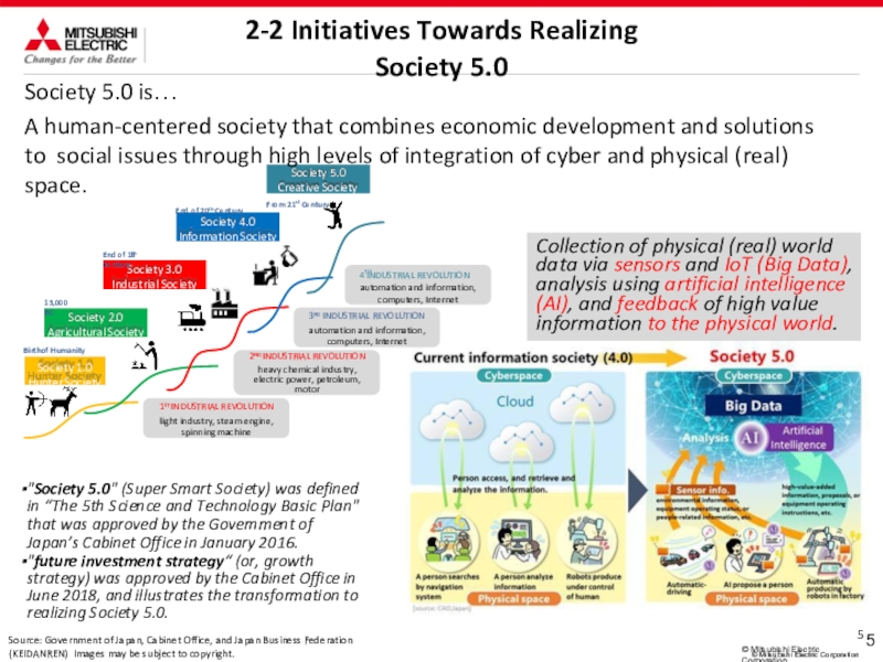
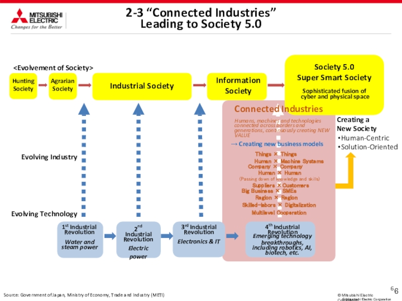
and ITS
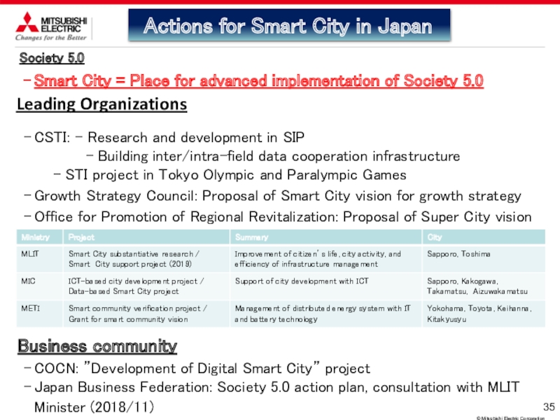
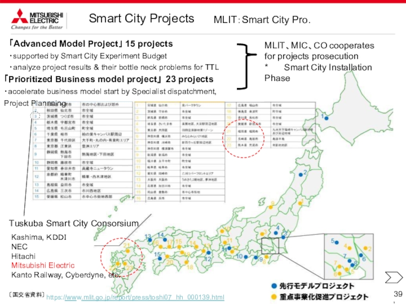
Combination of
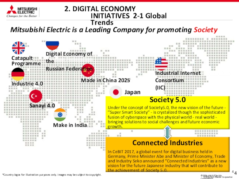
sensing technology and vehicle control technology
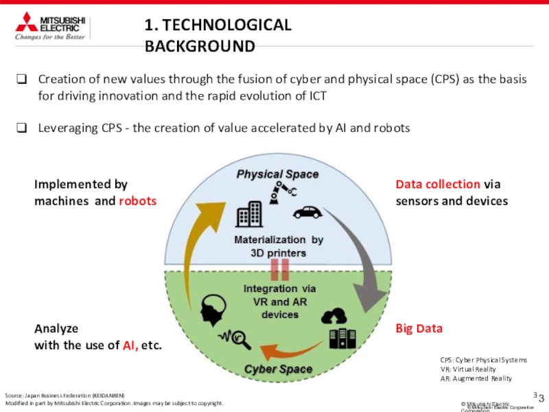
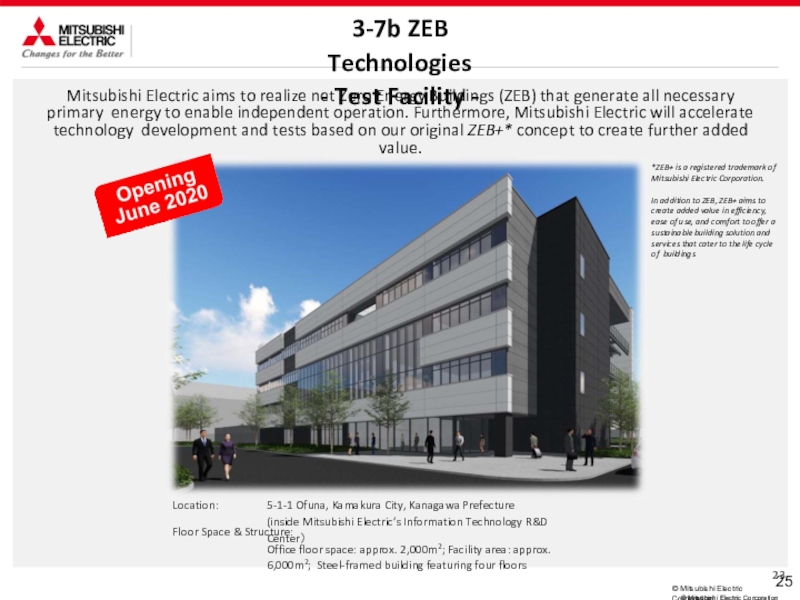
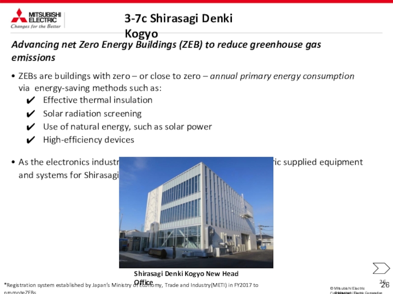
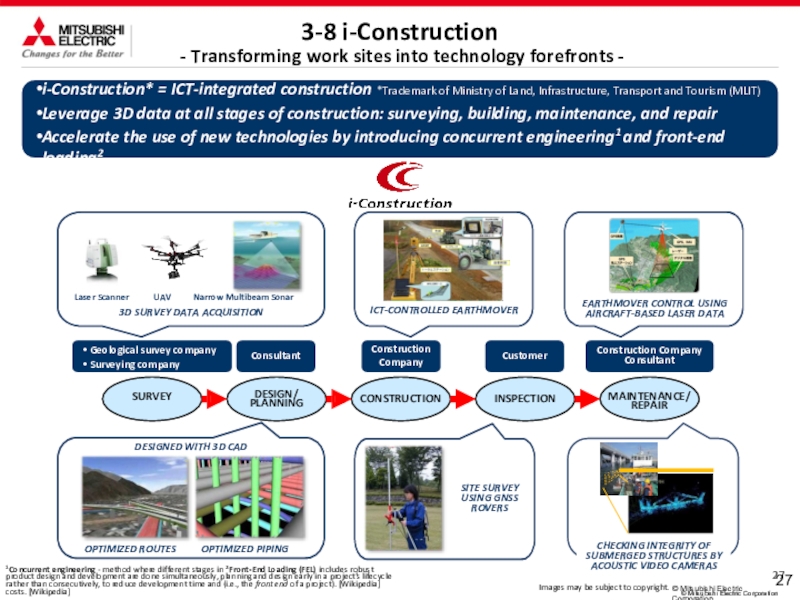
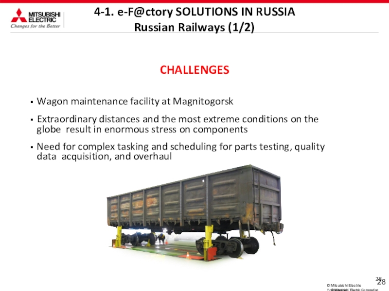
*ITS - Intelligent
Transport Systems,
ADAS - Advanced Driving Assistant System
C2X
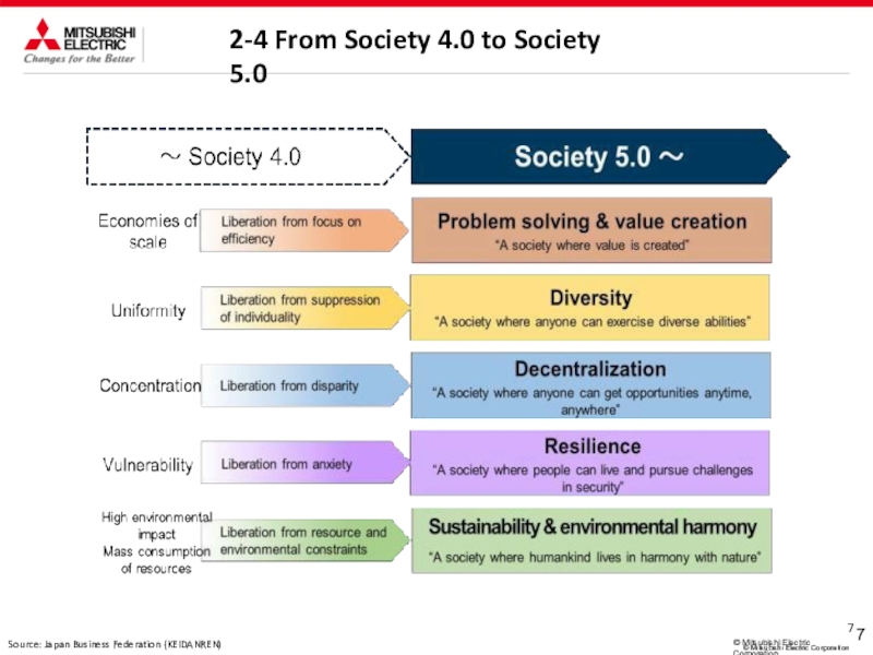
onboard equipment
ETC2.0(DSRC)
ECU (ADAS, etc.)
EPS system products
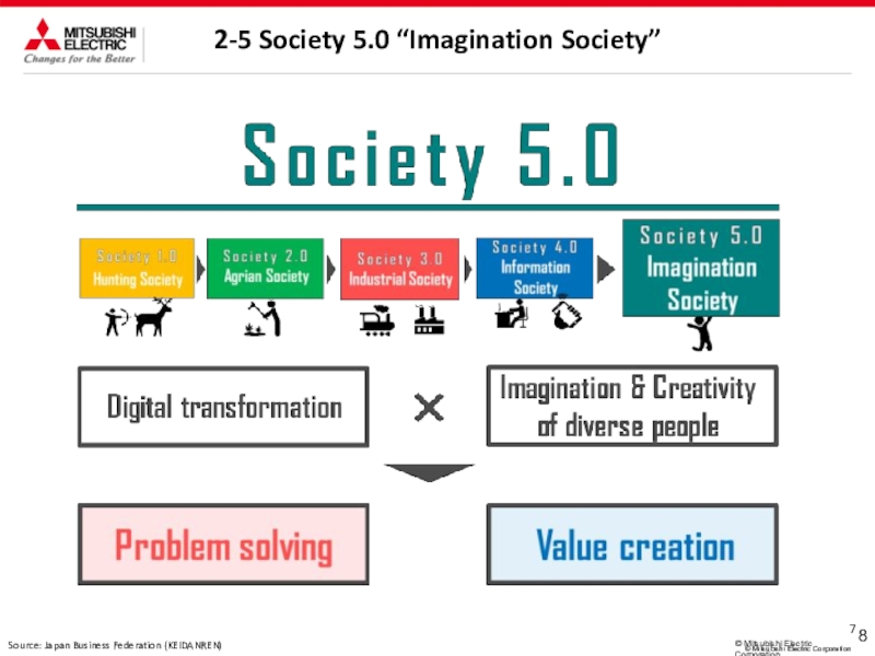
Test drive with the automated driving
concept car “EMIRAI3 xAUTO”
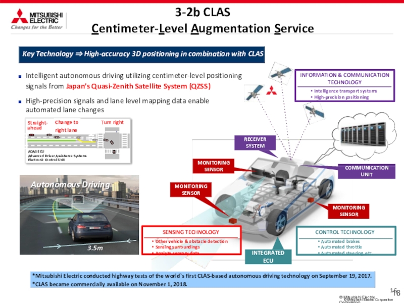
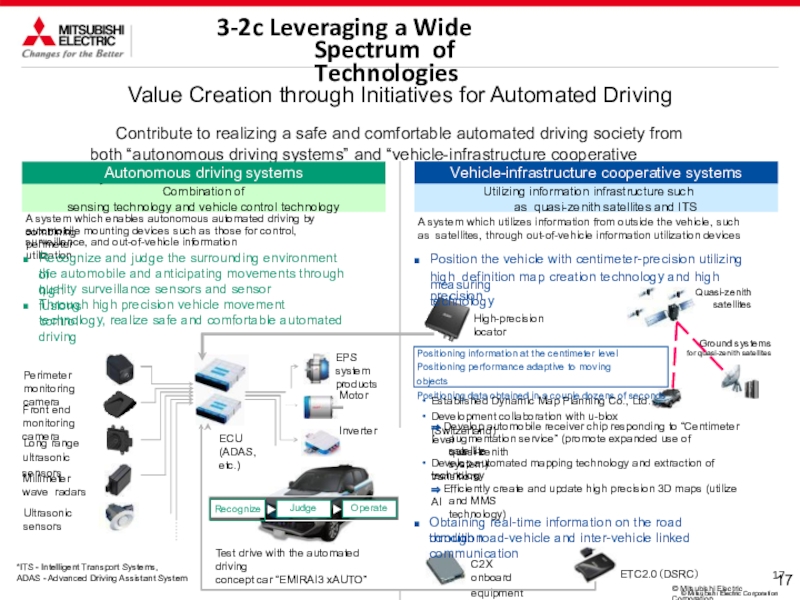
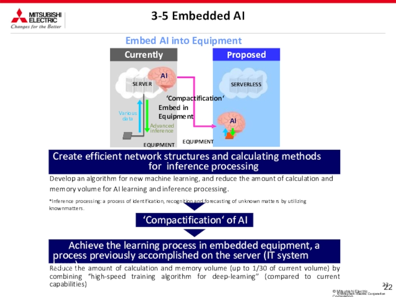
A system which enables autonomous automated driving by combining
automobile mounting devices such as those for control, perimeter
surveillance, and out-of-vehicle information utilization
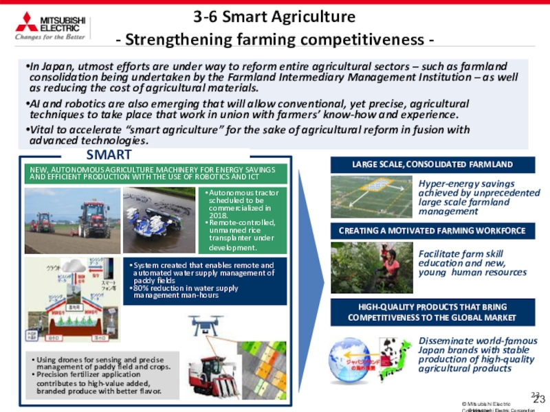
Recognize and judge the surrounding environment of
the automobile and anticipating movements through high
quality surveillance sensors and sensor fusions
Through high precision vehicle movement control
technology, realize safe and comfortable automated driving
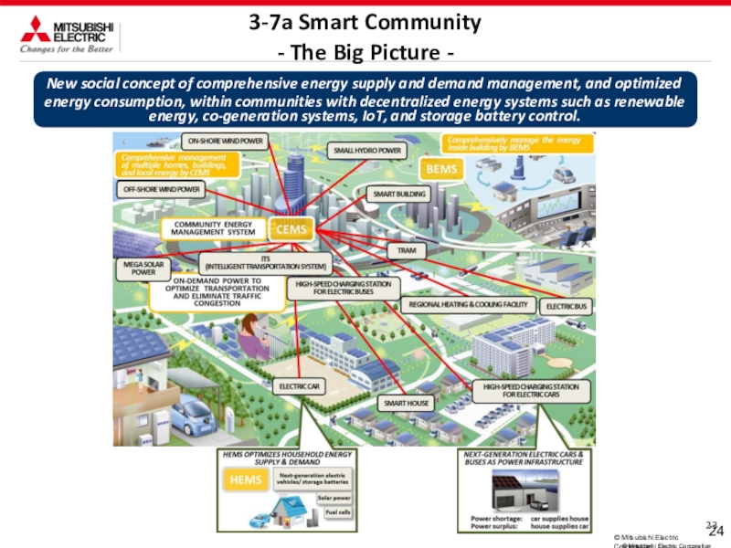
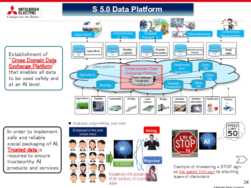
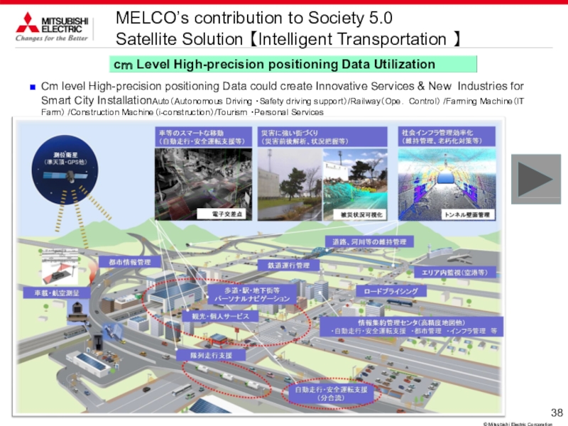
A system which utilizes information from outside the vehicle, such as satellites, through out-of-vehicle information utilization devices
Position the vehicle with centimeter-precision utilizing high definition map creation technology and high precision
measuring technology
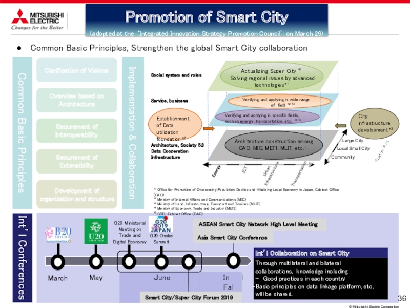
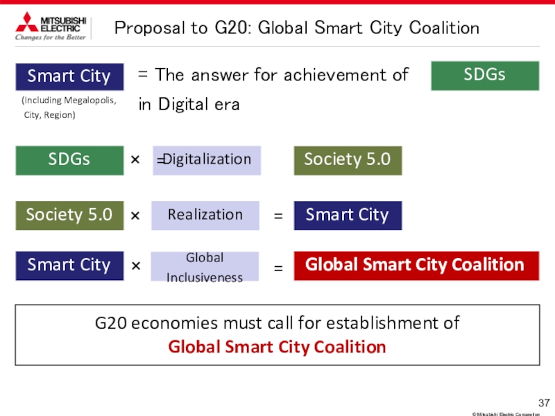
Value Creation through Initiatives for Automated Driving
Contribute to realizing a safe and comfortable automated driving society from both “autonomous driving systems” and “vehicle-infrastructure cooperative systems”
Autonomous driving systems
Vehicle-infrastructure cooperative systems
Recognize
Judge
Operate
Quasi-zenith
satellites
© Mitsubishi Electric Corporation
Ground systems
for quasi-zenith satellites
Motor
Inverter
Perimeter monitoring camera
Front end monitoring camera
Long range
ultrasonic sensors
Millimeter wave radars
Ultrasonic sensors
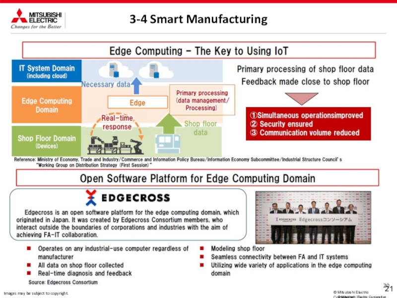
Positioning information at the centimeter level Positioning performance adaptive to moving objects
Positioning data obtained in a couple dozens of seconds
High-precision locator
Established Dynamic Map Planning Co., Ltd.
Development collaboration with u-blox (Switzerland)
⇒ Develop automobile receiver chip responding to “Centimeter level
augmentation service” (promote expanded use of quasi-zenith
satellite system)
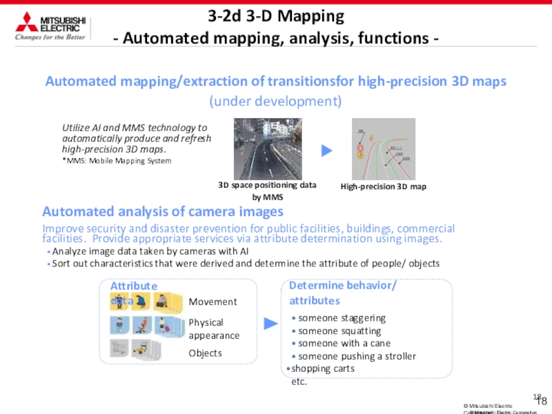
Develop automated mapping technology and extraction of transitions
technology
⇒ Efficiently create and update high precision 3D maps (utilize AI
and MMS technology)
Obtaining real-time information on the road condition
through road-vehicle and inter-vehicle linked communication
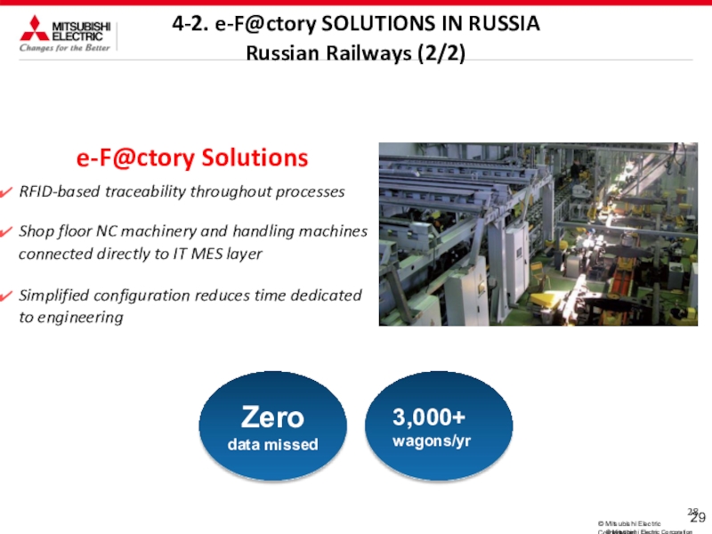
3-2c Leveraging a Wide Spectrum of Technologies
