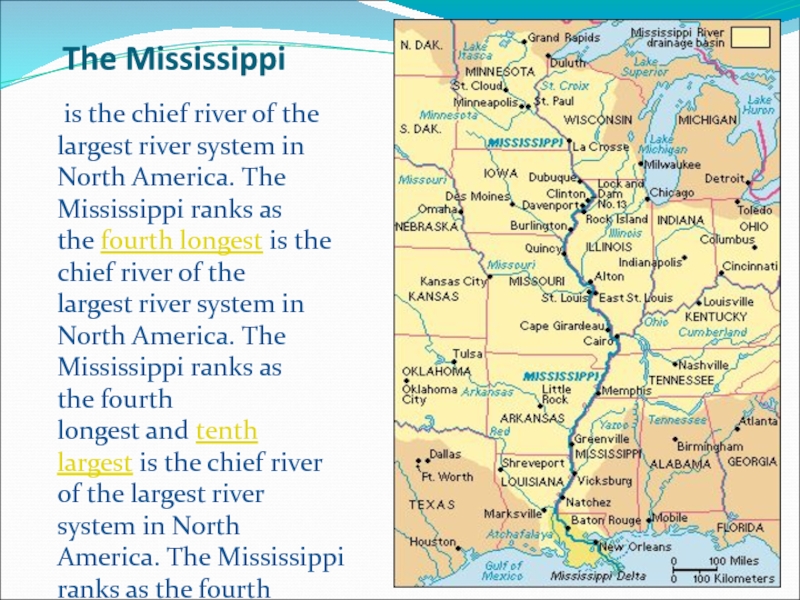
Слайд 4The Mississippi
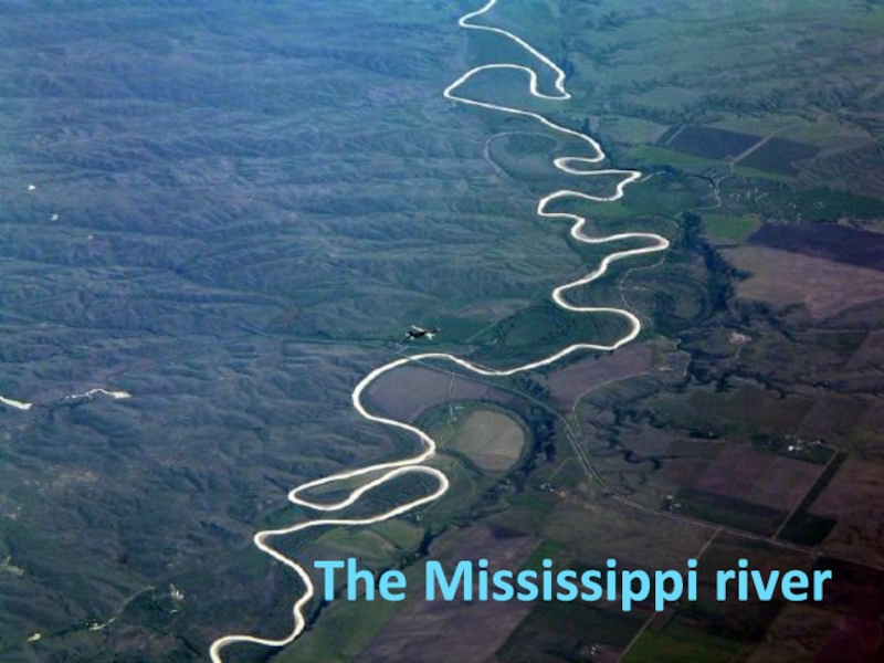
is the chief river of the largest river system in North
America. The Mississippi ranks as the fourth longest is the chief river
of the largest river system in North America. The Mississippi ranks as the fourth longest and tenth largest is the chief river of the largest river system in North America. The Mississippi ranks as the fourth longest and tenth largest river in the world. The river either borders or cuts through the states of Minnesota is the chief river of the largest river system in North America. The Mississippi ranks as the fourth longest and tenth largest river in the world. The river either borders or cuts through the states of Minnesota, Wisconsin is the chief river of the largest river system in North America. The Mississippi ranks as the fourth longest and tenth largest river in the world. The river either borders or cuts through the states of Minnesota, Wisconsin, Iowa is the chief river of the largest river system in North America. The Mississippi ranks as the fourth longest and tenth largest river in the world. The river either borders or cuts through the states of Minnesota, Wisconsin, Iowa, Illinois is the chief river of the largest river system in North America. The Mississippi ranks as the fourth longest and tenth largest river in the world. The river either borders or cuts through the states of Minnesota, Wisconsin, Iowa, Illinois, Missouri is the chief river of the largest river system in North America. The Mississippi ranks as the fourth longest and tenth largest river in the world. The river either borders or cuts through the states of Minnesota, Wisconsin, Iowa, Illinois, Missouri, Kentucky is the chief river of the largest river system in North America. The Mississippi ranks as the fourth longest and tenth largest river in the world. The river either borders or cuts through the states of Minnesota, Wisconsin, Iowa, Illinois, Missouri, Kentucky,Tennessee is the chief river of the largest river system in North America. The Mississippi ranks as the fourth longest and tenth largest river in the world. The river either borders or cuts through the states of Minnesota, Wisconsin, Iowa, Illinois, Missouri, Kentucky,Tennessee, Arkansas is the chief river of the largest river system in North America. The Mississippi ranks as the fourth longest and tenth largest river in the world. The river either borders or cuts through the states of Minnesota, Wisconsin, Iowa, Illinois, Missouri, Kentucky,Tennessee, Arkansas, Mississippi is the chief river of the largest river system in North America. The Mississippi ranks as the fourth longest and tenth largest river in the world. The river either borders or cuts through the states of Minnesota, Wisconsin, Iowa, Illinois, Missouri, Kentucky,Tennessee, Arkansas, Mississippi, and Louisiana.
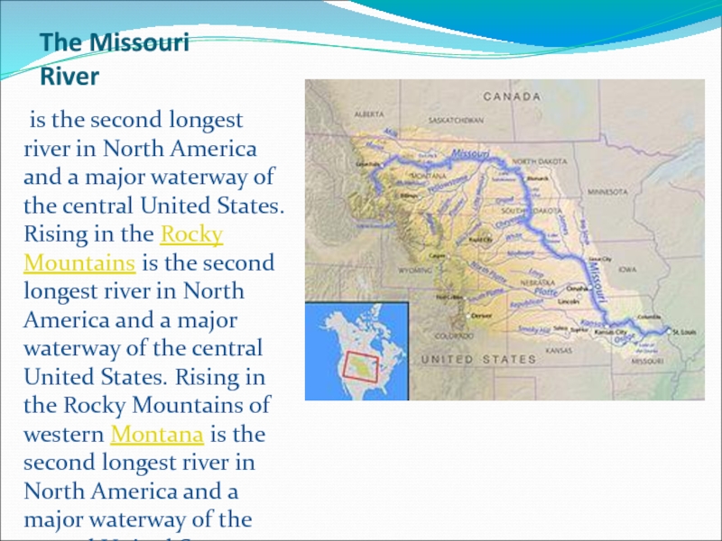
Слайд 6The Missouri River
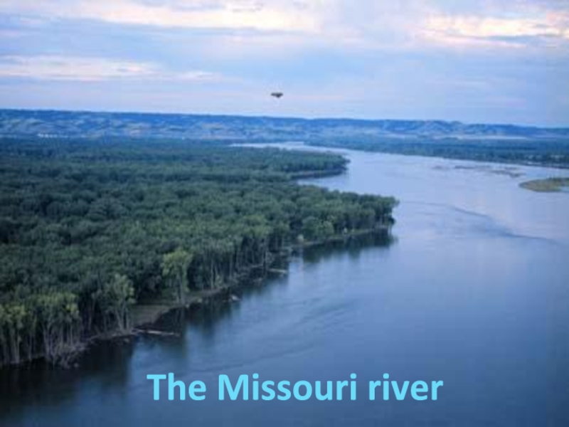
is the second longest river in North America and
a major waterway of the central United States. Rising in
the Rocky Mountains is the second longest river in North America and a major waterway of the central United States. Rising in the Rocky Mountains of western Montana is the second longest river in North America and a major waterway of the central United States. Rising in the Rocky Mountains of western Montana, the Missouri flows east and south for 2,341 miles (3,767 km) before entering the Mississippi River is the second longest river in North America and a major waterway of the central United States. Rising in the Rocky Mountains of western Montana, the Missouri flows east and south for 2,341 miles (3,767 km) before entering the Mississippi River north of St. Louis, Missouri.
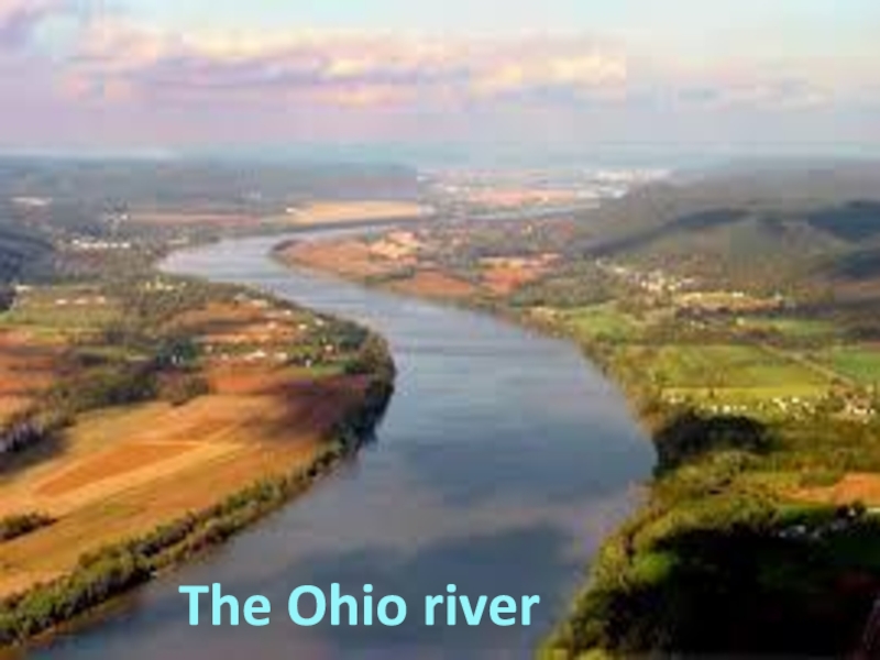
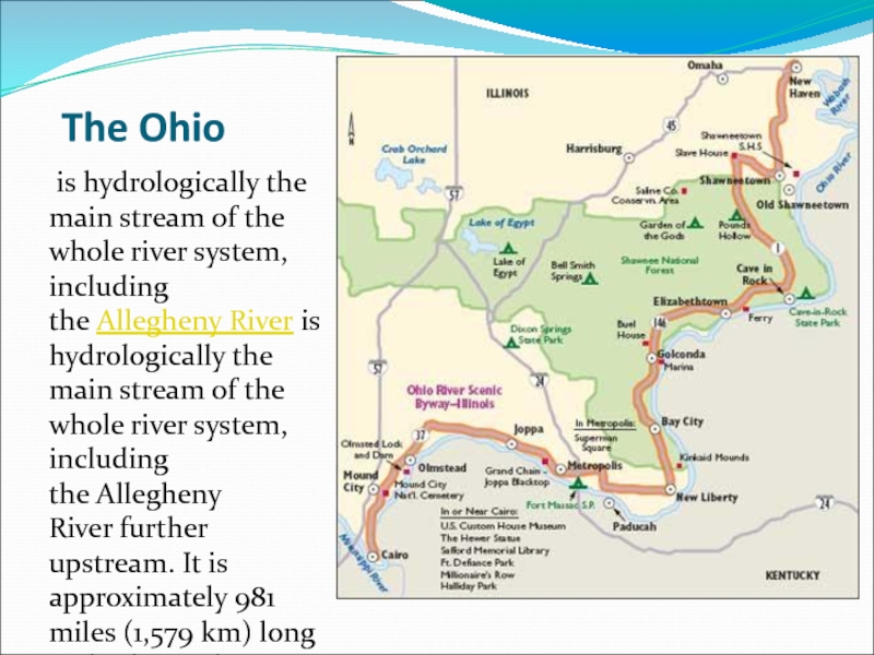
Слайд 8The Ohio
is hydrologically the main stream of the whole river
system, including the Allegheny River is hydrologically the main stream of the
whole river system, including the Allegheny River further upstream. It is approximately 981 miles (1,579 km) long and is located in the Eastern United States.
Слайд 10The Columbia
is the largest riveris the largest river in the Pacific Northwestis the largest river in
the Pacific Northwest region of North America.[9] The river rises The river rises in the Rocky Mountains The river rises in the Rocky
Mountains of British Columbia The river rises in the Rocky Mountains of British Columbia, Canada The river rises in the Rocky Mountains of British Columbia, Canada. The river is 1,243 miles (2,000 km) long, and its largest tributary The river rises in the Rocky Mountains of British Columbia, Canada. The river is 1,243 miles (2,000 km) long, and its largest tributary is the Snake River. the Columbia is the fourth-largest river in the United States; it has the greatest flow of any North American river draining into the Pacific.
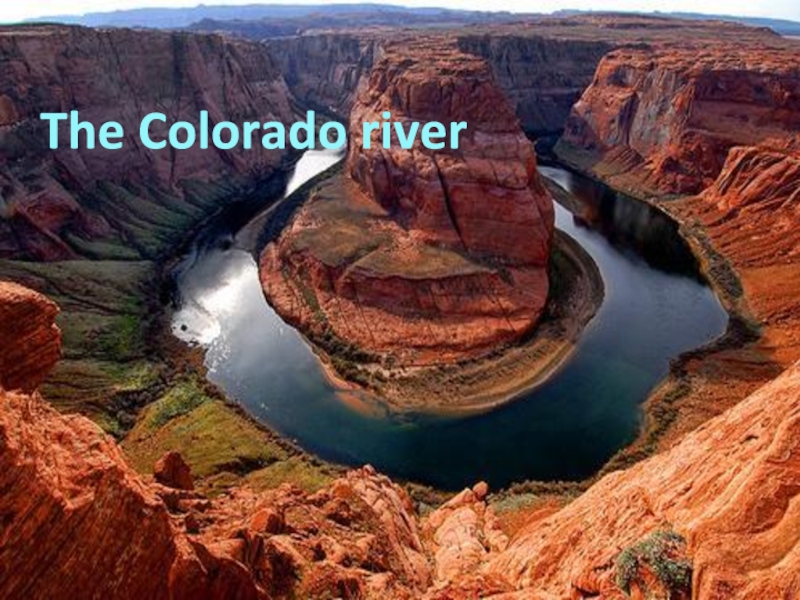
Слайд 12The Colorado
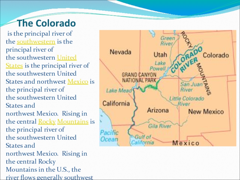
is the principal river of the southwestern is the principal river
of the southwestern United States is the principal river of the southwestern United States and northwest Mexico is
the principal river of the southwestern United States and northwest Mexico. Rising in the central Rocky Mountains is the principal river of the southwestern United States and northwest Mexico. Rising in the central Rocky Mountains in the U.S., the river flows generally southwest across the Colorado Plateau is the principal river of the southwestern United States and northwest Mexico. Rising in the central Rocky Mountains in the U.S., the river flows generally southwest across the Colorado Plateau before reaching Lake Mead is the principal river of the southwestern United States and northwest Mexico. Rising in the central Rocky Mountains in the U.S., the river flows generally southwest across the Colorado Plateau before reaching Lake Mead on the Arizona is the principal river of the southwestern United States and northwest Mexico. Rising in the central Rocky Mountains in the U.S., the river flows generally southwest across the Colorado Plateau before reaching Lake Mead on the Arizona–Nevada is the principal river of the southwestern United States and northwest Mexico. Rising in the central Rocky Mountains in the U.S., the river flows generally southwest across the Colorado Plateau before reaching Lake Mead on the Arizona–Nevada line, where it turns south towards the international border. After entering Mexico, the Colorado forms a large delta is the principal river of the southwestern United States and northwest Mexico. Rising in the central Rocky Mountains in the U.S., the river flows generally southwest across the Colorado Plateau before reaching Lake Mead on the Arizona–Nevada line, where it turns south towards the international border. After entering Mexico, the Colorado forms a large delta, emptying into the Gulf of California is the principal river of the southwestern United States and northwest Mexico. Rising in the central Rocky Mountains in the U.S., the river flows generally southwest across the Colorado Plateau before reaching Lake Mead on the Arizona–Nevada line, where it turns south towards the international border. After entering Mexico, the Colorado forms a large delta, emptying into the Gulf of California between Baja California is the principal river of the southwestern United States and northwest Mexico. Rising in the central Rocky Mountains in the U.S., the river flows generally southwest across the Colorado Plateau before reaching Lake Mead on the Arizona–Nevada line, where it turns south towards the international border. After entering Mexico, the Colorado forms a large delta, emptying into the Gulf of California between Baja California and Sonora.
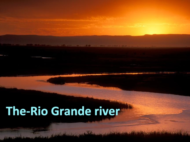
Слайд 14The Rio-Grande
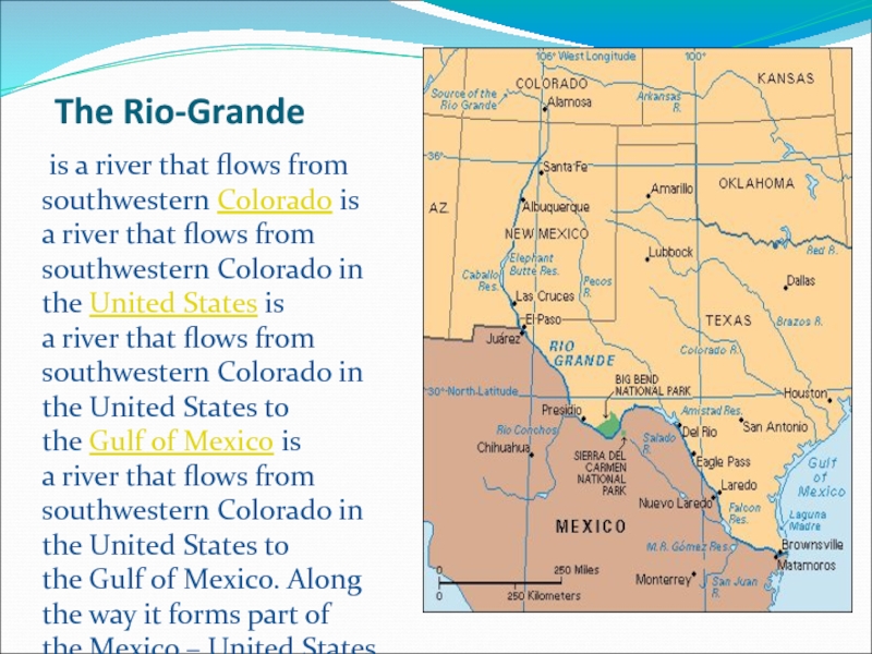
is a river that flows from southwestern Colorado is a river that flows from southwestern Colorado in
the United States is a river that flows from southwestern Colorado in the United States to the Gulf of
Mexico is a river that flows from southwestern Colorado in the United States to the Gulf of Mexico. Along the way it forms part of the Mexico – United States border. The river serves as a natural border between the U.S. state is a river that flows from southwestern Colorado in the United States to the Gulf of Mexico. Along the way it forms part of the Mexico – United States border. The river serves as a natural border between the U.S. state of Texas is a river that flows from southwestern Colorado in the United States to the Gulf of Mexico. Along the way it forms part of the Mexico – United States border. The river serves as a natural border between the U.S. state of Texas and the Mexican is a river that flows from southwestern Colorado in the United States to the Gulf of Mexico. Along the way it forms part of the Mexico – United States border. The river serves as a natural border between the U.S. state of Texas and the Mexican states ofChihuahua is a river that flows from southwestern Colorado in the United States to the Gulf of Mexico. Along the way it forms part of the Mexico – United States border. The river serves as a natural border between the U.S. state of Texas and the Mexican states ofChihuahua, Coahuila is a river that flows from southwestern Colorado in the United States to the Gulf of Mexico. Along the way it forms part of the Mexico – United States border. The river serves as a natural border between the U.S. state of Texas and the Mexican states ofChihuahua, Coahuila, Nuevo León is a river that flows from southwestern Colorado in the United States to the Gulf of Mexico. Along the way it forms part of the Mexico – United States border. The river serves as a natural border between the U.S. state of Texas and the Mexican states ofChihuahua, Coahuila, Nuevo León, and Tamaulipas.




![The rivers of America The Columbiais the largest riveris the largest river in the Pacific Northwestis the largest river in the Pacific The Columbiais the largest riveris the largest river in the Pacific Northwestis the largest river in the Pacific Northwest region of North America.[9] The river rises The river rises in the Rocky](/img/thumbs/75fe9dbf48dca9379a4befbda82add10-800x.jpg)
