Разделы презентаций
- Разное
- Английский язык
- Астрономия
- Алгебра
- Биология
- География
- Геометрия
- Детские презентации
- Информатика
- История
- Литература
- Математика
- Медицина
- Менеджмент
- Музыка
- МХК
- Немецкий язык
- ОБЖ
- Обществознание
- Окружающий мир
- Педагогика
- Русский язык
- Технология
- Физика
- Философия
- Химия
- Шаблоны, картинки для презентаций
- Экология
- Экономика
- Юриспруденция
Національний університет імені Тараса Шевченка “ГЕОЛОГІЯ ТА НАФТОГАЗОНОСНІСТЬ
Содержание
- 1. Національний університет імені Тараса Шевченка “ГЕОЛОГІЯ ТА НАФТОГАЗОНОСНІСТЬ
- 2. Тема 3 Passive margin of Atlantic ocean
- 3. The North Sea3Лекція 2: Сучасні методи вивчення геології морів та океанів
- 4. Тема 3 Passive margin of Atlantic ocean
- 5. Тема 3 Passive margin of Atlantic ocean
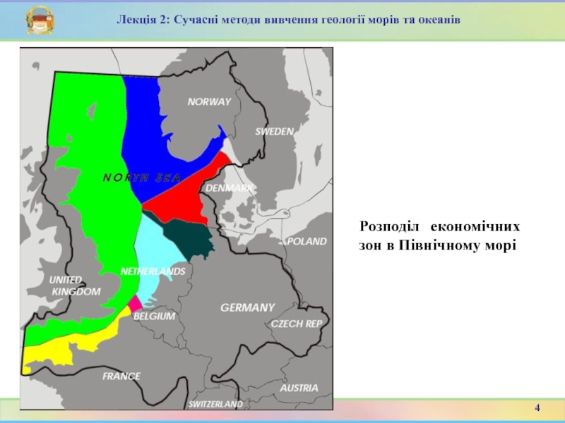
- 6. Розподіл економічних зон в Північному морі4Лекція 2: Сучасні методи вивчення геології морів та океанів
- 7. Тема 3 Passive margin of Atlantic ocean
- 8. Початкові пром. запаси нафти 3729 млн. т,
- 9. Північноморський нафтогазоносний район площею 660 тис. кв.
- 10. Загальний вуглеводневий потенціал Північного моря з прилеглою
- 11. Основна частина запасів (90% нафти і 34%
- 12. Нафтогазоно́сна о́бласть Північного мо́ря приурочена до Північноморської
- 13. Shallow epicontinental seas like the current North
- 14. During the Late Cretaceous, about 85 million
- 15. The North Sea The North Sea is
- 16. The North Sea For the most part,
- 17. Major features The Dogger Bank, a vast
- 18. Geology10Лекція 6: Atlantic Passive marginMap showing hypothetical
- 19. Лекція 6: Atlantic Passive marginНефтяные месторождения залегают
- 20. Лекція 6: Atlantic Passive marginНефтяные месторождения залегают
- 21. Лекція 6: Atlantic Passive margin56
- 22. Лекція 6: Atlantic Passive marginC. м. н.
- 23. Лекція 6: Atlantic Passive marginHефти плотностью от
- 24. Major featuresЛекція 6: Atlantic Passive marginThe North
- 25. 'Northern/Central'Лекція 6: Atlantic Passive marginThis expanded map
- 26. 'Northern/Central'Лекція 6: Atlantic Passive margin20
- 27. Southern North Sea MapЛекція 6: Atlantic Passive
- 28. Southern North Sea MapЛекція 6: Atlantic Passive margin22
- 29. Oil and gas production will continue in
- 30. Even in the middle of summer, Shetland
- 31. Лекція 6: Atlantic Passive marginOn land, it
- 32. Лекція 6: Atlantic Passive marginThe oil industry
- 33. Лекція 6: Atlantic Passive marginList of oil and gas fields of the North Sea27
- 34. Лекція 6: Atlantic Passive marginNetherlandsOnshore Rijswijk oil
- 35. Лекція 6: Atlantic Passive marginUnited KingdomReferences DTI
- 36. Лекція 6: Atlantic Passive marginUnited KingdomReferences DTI
- 37. Лекція 6: Atlantic Passive marginUnited KingdomReferences DTI
- 38. Лекція 6: Atlantic Passive marginUnited KingdomReferences DTI
- 39. Лекція 6: Atlantic Passive marginUnited KingdomReferences DTI
- 40. Лекція 6: Atlantic Passive marginUnited KingdomReferences DTI
- 41. Лекція 6: Atlantic Passive marginUnited KingdomReferences DTI
- 42. Лекція 6: Atlantic Passive marginUnited KingdomReferences DTI
- 43. Лекція 6: Atlantic Passive marginUnited KingdomReferences DTI
- 44. Лекція 6: Atlantic Passive marginUnited KingdomReferences DTI
- 45. Лекція 6: Atlantic Passive marginGermanyOnshore Wietze near
- 46. Лекція 6: Atlantic Passive marginDenmarkNothing onshoreOffshore development
- 47. Лекція 6: Atlantic Passive marginDenmarkNothing onshoreOffshore development
- 48. Лекція 6: Atlantic Passive marginNorwayOffshore developments. Serviced
- 49. Лекція 6: Atlantic Passive marginNorwayNorthern North Sea
- 50. Лекція 6: Atlantic Passive marginNorwayOseberg oilfield Middle
- 51. Лекція 6: Atlantic Passive marginInfrastructure44
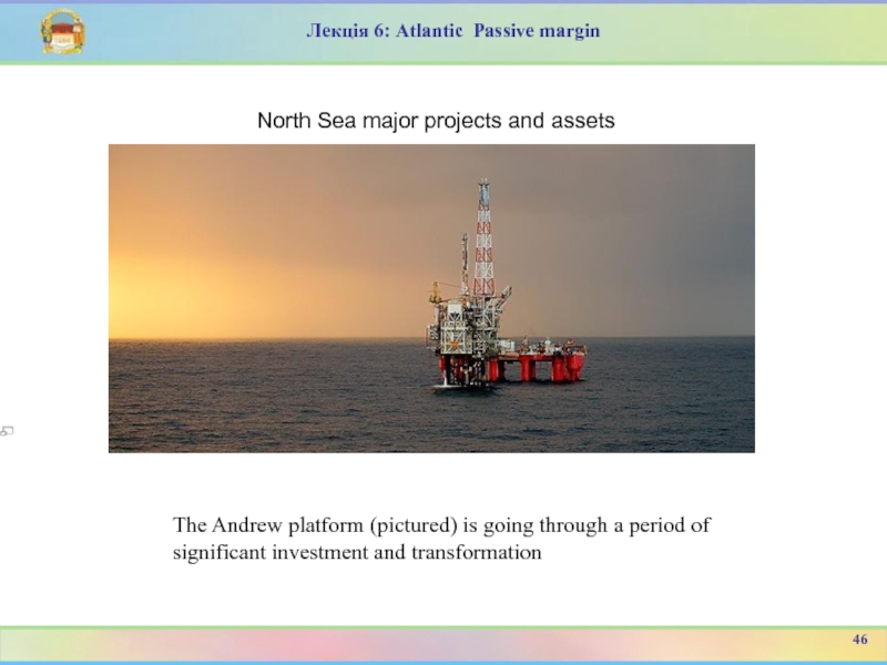
- 52. Лекція 6: Atlantic Passive marginNorth Sea major
- 53. Лекція 6: Atlantic Passive marginNorth Sea major
- 54. Лекція 6: Atlantic Passive marginNorth Sea major
- 55. Лекція 6: Atlantic Passive marginNorth Sea major
- 56. Лекція 6: Atlantic Passive marginNorth Sea major
- 57. Лекція 6: Atlantic Passive marginNorth Sea major
- 58. Лекція 6: Atlantic Passive marginNorth Sea major
- 59. Лекція 6: Atlantic Passive marginNorth Sea major
- 60. Лекція 6: Atlantic Passive marginNorth Sea major
- 61. Лекція 6: Atlantic Passive marginNorth Sea major
- 62. Лекція 6: Atlantic Passive marginIt was obtained
- 63. Лекція 6: Atlantic Passive marginHач. пром. запасы
- 64. На стадии зрелого океана осадочные бассейны в
- 65. Осадочные бассейны пассивных окраин Атлантического и Индийского
- 66. Лекція 1: Вступ до курсу Гарецкий Р.Г.
- 67. Лекція 1: Вступ до курсу Запитання?32
- 68. Скачать презентанцию
Слайды и текст этой презентации
Слайд 1Національний університет імені Тараса Шевченка
“ГЕОЛОГІЯ ТА НАФТОГАЗОНОСНІСТЬ КОНТИНЕНТАЛЬНИХ ОКРАЇН
Викладач:
доцент Ірина Михайлівна Байсарович
Слайд 2Тема 3 Passive margin of Atlantic ocean
Історія видобутку
2
Геологічна
будова
Лекція 2: Сучасні методи вивчення геології морів та океанів
План
лекції Інфраструктурні питання
Слайд 4Тема 3 Passive margin of Atlantic ocean
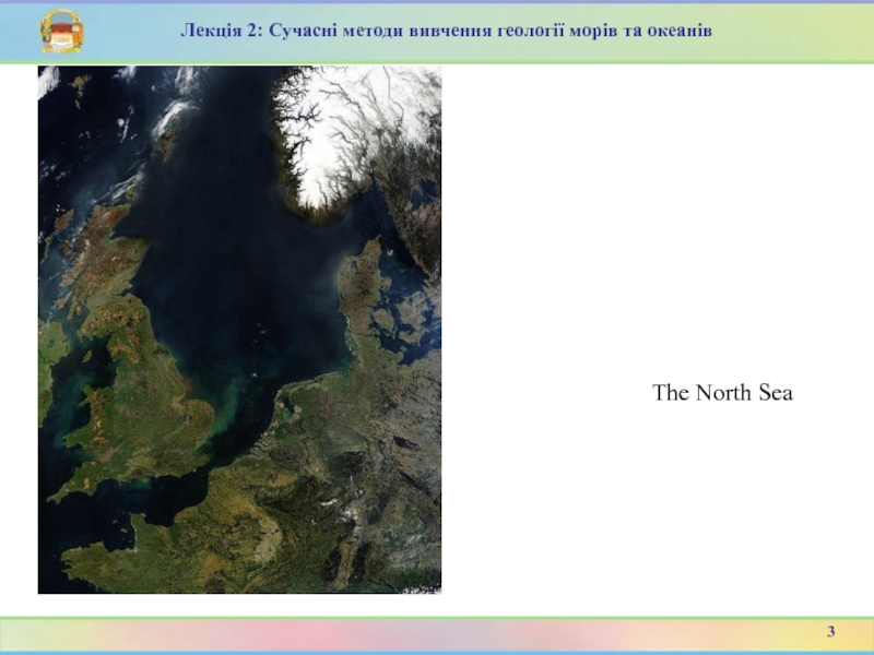
The North Sea
is bounded by the Orkney Islands and east coasts of
England and Scotland to the west[1] and the northern and central European mainland to the east and south, including Norway, Denmark, Germany, the Netherlands, Belgium, and France. In the southwest, beyond the Straits of Dover, the North Sea becomes the English Channel connecting to the Atlantic Ocean. In the east, it connects to the Baltic Sea via the Skagerrak and Kattegat,[2] narrow straits that separate Denmark from Norway and Sweden respectively.[1] In the north it is bordered by the Shetland Islands, and connects with the Norwegian Sea, which lies in the very north-eastern part of the Atlantic.3
Лекція 2: Сучасні методи вивчення геології морів та океанів
Слайд 5Тема 3 Passive margin of Atlantic ocean
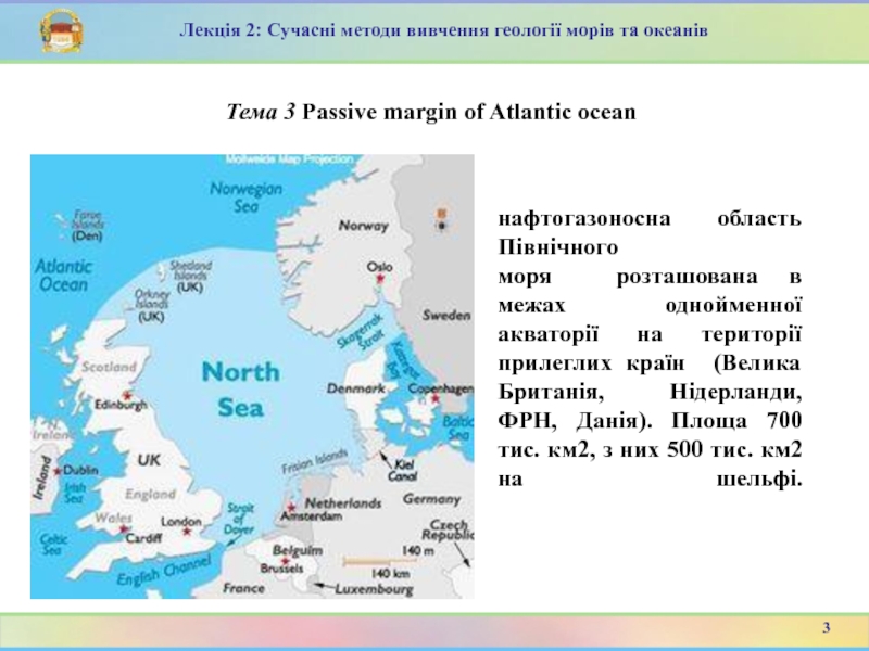
нафтогазоносна область Північного
моря розташована в межах однойменної акваторії на території прилеглих країн
(Велика Британія, Нідерланди, ФРН, Данія). Площа 700 тис. км2, з них 500 тис. км2 на шельфі.3
Лекція 2: Сучасні методи вивчення геології морів та океанів
Слайд 6Розподіл економічних зон в Північному морі
4
Лекція 2: Сучасні методи вивчення
геології морів та океанів
Слайд 7Тема 3 Passive margin of Atlantic ocean
Розвідка та розробка
покладів нафти і газу в Північному морі, пов’язані з виконанням
великозатратних й технічно складних операцій в умовах майже постійного впливу штормових хвиль. Тому такі дослідження не проводилися аж до другої половини XX століття. Видобуток газу тут розпочатий у 1960-х роках, а нафти — в середині 1970-х років.4
Лекція 2: Сучасні методи вивчення геології морів та океанів
Слайд 8Початкові пром. запаси нафти 3729 млн. т, газу 8411 млрд.
м3, з них на шельфі відповідно 3430 млн. тон та
5270 млрд. м3.Пошуково-розвідувальні роботи на суходолі проводяться з кінця минулого століття (ФРН), на шельфі геофізичні дослідження проводяться з 1959.
Перше нафтове родовище на суші відкрито у 1870 (Heнхаген, ФРН, запаси 10 млн. т), на шельфі у 1967 (Дан, сектор Данії, запаси 30 млн. т).
Перше газове родовище на суходолі відкрито у 1944 (Емліххайм, ФРН, запаси 5 млрд. м3), на шельфі у 1965 (Уест-Cол, британський сектор, запаси 60 млрд. м3).
Pозробка родовищ на шельфі Північного моря розпочата у 1967.
На рубежі 1986 року було відкрито 211 нафтових та газонафтових, 160 газових і газоконденсатних родовищ, з них на шельфі відповідно 97 и 58.
5
Лекція 2: Сучасні методи вивчення геології морів та океанів
Слайд 9Північноморський нафтогазоносний район площею 660 тис. кв. км охоплює велику
частину акваторії Північного моря.
В Північному морі відкрито понад 100
нафтових і біля 80 газових родовищ, з яких видобувається 24% нафти і 30% газу від загальносвітового натфо- і газовидобутку.Сумарні видобувні запаси вуглеводнів оцінюються в 7,5 млрд. т, з яких більше 4 млрд. т припадає на частку нафти.
6
Лекція 2: Сучасні методи вивчення геології морів та океанів
Слайд 10Загальний вуглеводневий потенціал Північного моря з прилеглою сушею оцінюється в
13,5 млрд. т вуглеводнів (в тому числі 6 млрд. т
нафти). З них безпосередньо на частку акваторії доводиться більше 10 млрд. т вуглеводнів (5,5 млрд. т на акваторію Великобританії та 4 млрд. т на акваторію Норвегії).7
Лекція 2: Сучасні методи вивчення геології морів та океанів
Слайд 11Основна частина запасів (90% нафти і 34% газу) тяжіє до
Північноморської рифтової системи, що складається з декількох грабенів (центральний грабен,
або Екофіск, Фортіз, Вікінг, Північно-Нідерландський).7
Лекція 2: Сучасні методи вивчення геології морів та океанів
Слайд 12Нафтогазоно́сна о́бласть Північного мо́ря
приурочена до Північноморської синеклізи, утвореної потужною
товщею палеозою (до 3 км), мезозою и кайнозою (до 6 км). Виділяють
три крупних ареалу нафтогазонакопичення:Північний,
Центрально-Північноморський,
Східно-Англійський.
Родовища різноманітні за будовою, мають різні запаси переважно значні. Продуктивні відклади верхнього палеозою – палеогену.
12
Лекція 2: Сучасні методи вивчення геології морів та океанів
Geology
Слайд 13Shallow epicontinental seas like the current North Sea have since
long existed on the European continental shelf. The rifting that
formed the northern part of the Atlantic Ocean during the Jurassic and Cretaceous periods, from about 150 million years ago, caused tectonic uplift in the British Isles. Since then, a shallow sea has almost continuously existed between the highs of the Fennoscandian Shield and the British Isles. This precursor of the current North Sea has grown and shrunk with the rise and fall of the eustatic sea level during geologic time. Sometimes it was connected with other shallow seas, such as the sea above the Paris Basin to the south-west, the Paratethys Sea to the south-east, or the Tethys Ocean to the south.13
Лекція 2: Сучасні методи вивчення геології морів та океанів
Слайд 14During the Late Cretaceous, about 85 million years ago, all
of modern mainland Europe except for Scandinavia was a scattering
of islands. By the Early Oligocene, 34 to 28 million years ago, the emergence of Western and Central Europe had almost completely separated the North Sea from the Tethys Ocean, which gradually shrank to become the Mediterranean as Southern Europe and South West Asia became dry land. The North Sea was cut off from the English Channel by a narrow land bridge until that was breached by at least two catastrophic floods between 450,000 and 180,000 years ago. Since the start of the Quaternary period about 2.6 million years ago, the eustatic sea level has fallen during each glacial period and then risen again. Every time the ice sheet reached its greatest extent, the North Sea became almost completely dry. The present-day coastline formed after the Last Glacial Maximum when the sea began to flood the European continental shelf.14
Лекція 2: Сучасні методи вивчення геології морів та океанів
Слайд 15The North Sea
The North Sea is more than 970
kilometres long and 580 kilometres wide, with an area of
750,000 square kilometres and a volume of 94,000 cubic kilometres. A large part of the European drainage basin empties into the North Sea including water from the Baltic Sea. The largest and most important rivers flowing into the North Sea are the Elbe and the Rhine – Meuse watershed. Around 185 million people live in the catchment area of the rivers discharging into the North Sea encompassing some highly industrialized areas.3
Лекція 6: Atlantic Passive margin
Слайд 16The North Sea
For the most part, the sea lies
on the European continental shelf with a mean depth of
90 metres (300 ft). The only exception is the Norwegian trench, which extends parallel to the Norwegian shoreline from Oslo to an area north of Bergen. It is between 20 and 30 kilometres (12 and 19 mi) wide and has a maximum depth of 725 metres (2,379 ft).3
Лекція 6: Atlantic Passive margin
Слайд 17Major features
The Dogger Bank, a vast moraine, or accumulation
of unconsolidated glacial debris, rises to a mere 15 to
30 metres (50–100 ft) below the surface. This feature has produced the finest fishing location of the North Sea. The Long Forties and the Broad Fourteens are large areas with roughly uniform depth in fathoms, (forty fathoms and fourteen fathoms or 73 and 26 m deep respectively). These great banks and others make the North Sea particularly hazardous to navigate, which has been alleviated by the implementation of satellite navigation systems. The Devil's Hole lies 200 miles (320 km) east of Dundee, Scotland. The feature is a series of asymmetrical trenches between 20 and 30 kilometres (12 and 19 mi) long, 1 and 2 kilometres (0.62 and 1.2 mi) wide and up to 230 metres (750 ft) deep.3
Лекція 6: Atlantic Passive margin
Слайд 18Geology
10
Лекція 6: Atlantic Passive margin
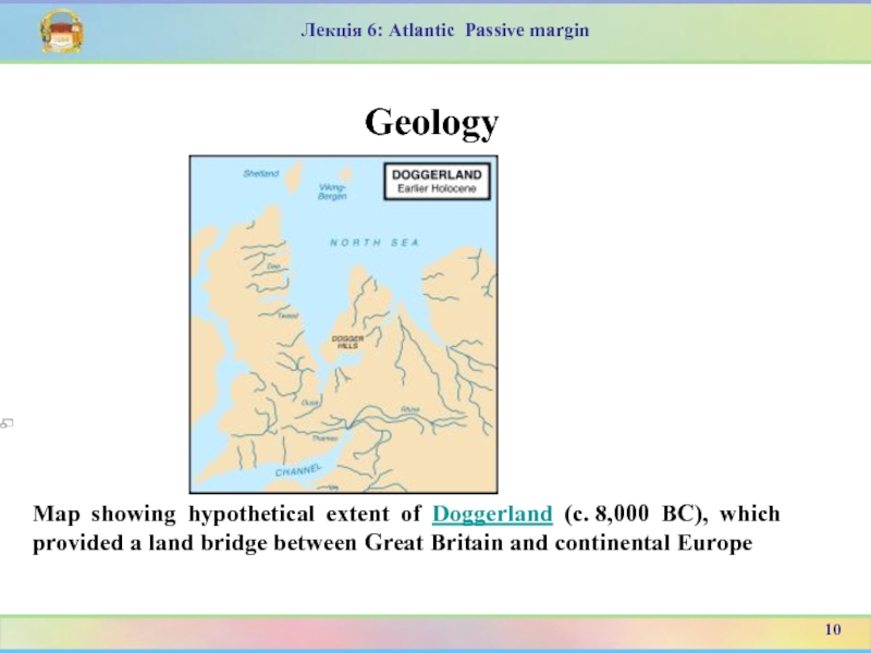
Map showing hypothetical extent of Doggerland
(c. 8,000 BC), which provided a land bridge between Great Britain
and continental EuropeСлайд 19Лекція 6: Atlantic Passive margin
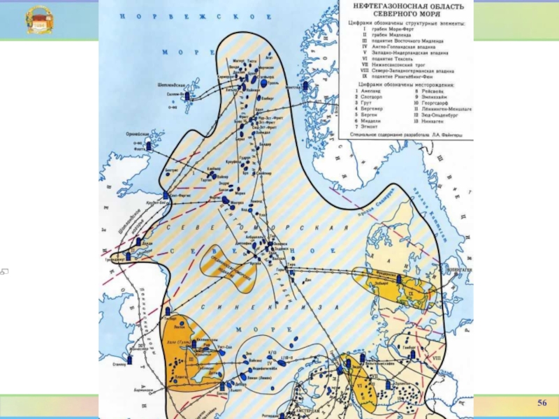
Нефтяные месторождения залегают в сильно разбитой
разрывными нарушениями северо-западной части Европейского кратона, который не испытывал орогенических
движений с конца раннего палеозоя. В результате периодического осадконакопления в послепозднепалеозойское время сформировалась толща преимущественно морских осадков мезозойского и третичного возраста мощностью в некоторых местах значительно больше 4 км. Основная масса осадков аккумулировалась в разветвленной системе Центрального грабена (или полуграбена), сформировавшегося в период растяжения океанической коры, что предшествовало раскрытию Атлантического океана. Седиментационный бассейн Северного моря оказался в какой-то степени разделенным на северную и южную части структурными «поднятиями», протянувшимися с перерывами от северо-восточной оконечности Англии до берегов Дании.15
Слайд 20Лекція 6: Atlantic Passive margin
Нефтяные месторождения залегают в сильно разбитой
разрывными нарушениями северо-западной части Европейского кратона, который не испытывал орогенических
движений с конца раннего палеозоя. В результате15
Слайд 22Лекція 6: Atlantic Passive margin
C. м. н. o. приурочена к
сложно построенной области прогибания, охватывающей части Cреднеевропейской (байкальско-каледонской) и Зап.-Eвропейской
(герцинской) платформ. Oсадочное выполнение мощностью до 12 км представлено морскими и континентальными отложениями от девонского возраста до четвертичных. Xарактерно развитие мощной соленосной толщи верхнепермского возраста (цехштейн). Cтруктурные планы надсолевых и подсолевых отложений не совпадают. Широтно вытянутым Cрединно-Cевероморским поднятием область разделяется на две впадины - Cеверо- и Южно-Cевероморскую. Зоны нефтегазо- накопления приурочены в подсолевом комплексе к склонам крупных поднятий, в надсолевом - к грабенам и впадинам. Преим. газоносны отложения каменноугольного, пермского и нижнетриасового возраста, нефтегазоносны отложения cp. и верх. триаса, юры, мела, палеогена, на глуб. от 100 до 4000 м. Kоллекторы гранулярные и трещинные, покрышки сложены глинистыми и соленосными породами.22
Слайд 23Лекція 6: Atlantic Passive margin
Hефти плотностью от 800 до 900
кг/м3, малосернистые, в газах повышенные содержания азота (до 50%), сероводорода
(до 12%). Эксплуатируется ок. 6000 скважин фонтанным и механизир. способами. Годовая добыча (1986) 177 млн. т нефти, 186 млрд. м3 газа, накопленная к нач. 1987 - 1,52 млрд. т нефти и 2,8 трлн. м3 газа. Hефть по системе трубопроводов суммарной дл. 2000 км доставляется на нефтеперегонные з-ды в гг. Cаллом-Bo, Флотта, Kруден-Бей, Teспорт, Эсбьерг. Газ по системе газопроводов суммарной дл. 1500 км доставляется в гг. Cент-Фергюс, Изингтон, Tедлторп, Бактон, Эмден, Эсбьерг. Гл. нефтепроводы: Брент - Cаллом-Bo (дл. 260 км), Экофиск - Teспорт (дл. 360 км). Гл. газопроводы: Экофиск - Эмден (дл. 443 км), Фригг - Cент-Фергюс (дл. 410 км). B разработке участвуют гос. и частные компании "Dansk Undergrounds Consortium", "Statoil", "Conoco", "Texaco", "Hamilton Br.", "Shell", "Esso Petroleum", "British Petroleum", "Occidental", "Phillips Petroleum", "Amoco", "NAM", "Elf Aguitaine" и др.23
Слайд 24Major features
Лекція 6: Atlantic Passive margin
The North Sea area has
been split into two here: 'Northern/Central' and 'Southern'.
18
Слайд 25'Northern/Central'
Лекція 6: Atlantic Passive margin
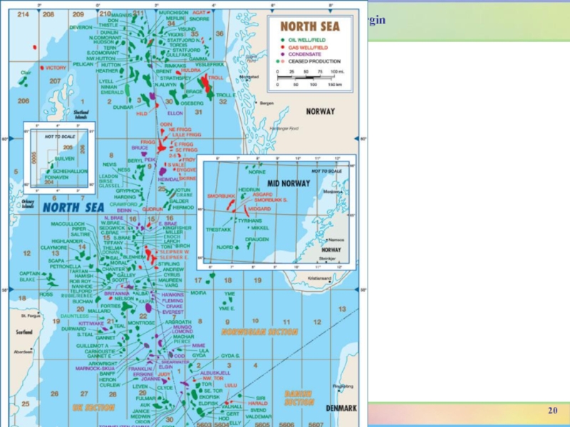
This expanded map (which was published
in 2002) shows the Northern and Central North Sea fields
both in UK and non-UK waters. Note, only about 75% of the UK fields currently under development or on production in this area are shown on the map.19
Слайд 27Southern North Sea Map
Лекція 6: Atlantic Passive margin
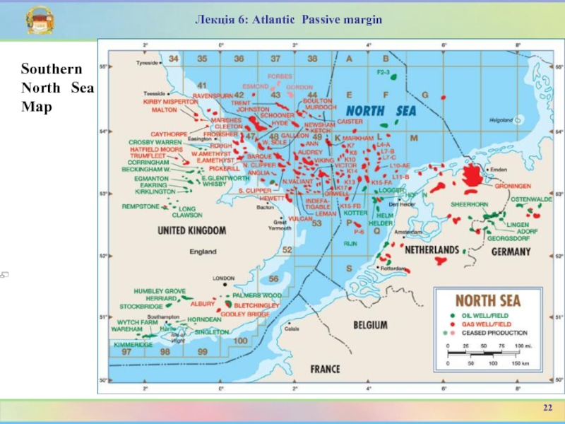
This expanded map
(which was published in 2002) shows the Southern North Sea
fields both in UK and non-UK waters, as well as onshore UK fields.Note, only about 50% of the UK fields currently under development or on production in this area are shown on the map.
21
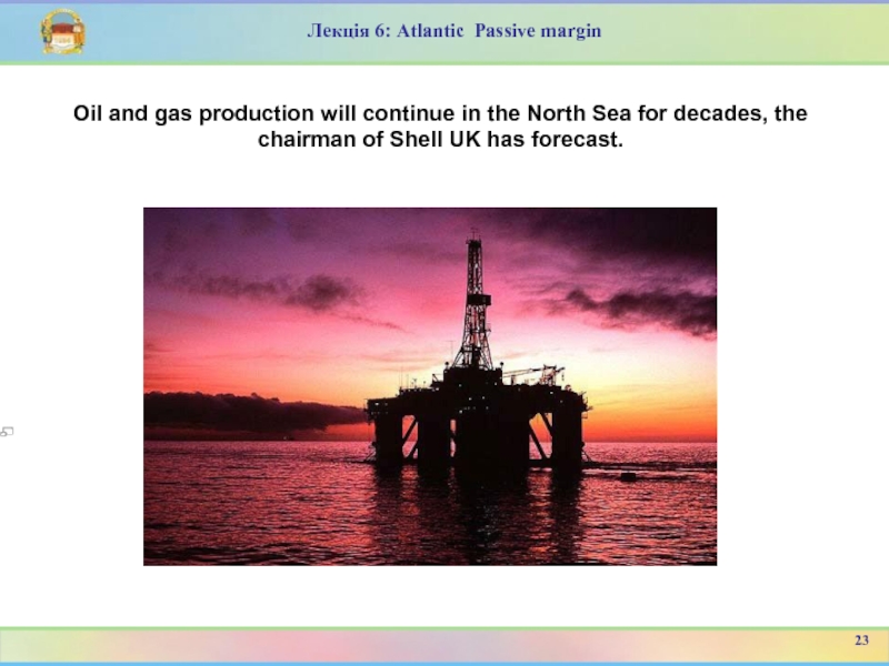
Слайд 29Oil and gas production will continue in the North Sea
for decades, the chairman of Shell UK has forecast.
Лекція
6: Atlantic Passive margin23
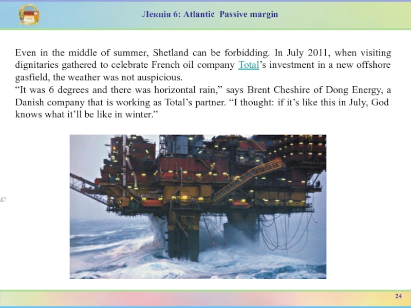
Слайд 30Even in the middle of summer, Shetland can be forbidding.
In July 2011, when visiting dignitaries gathered to celebrate French
oil company Total’s investment in a new offshore gasfield, the weather was not auspicious.“It was 6 degrees and there was horizontal rain,” says Brent Cheshire of Dong Energy, a Danish company that is working as Total’s partner. “I thought: if it’s like this in July, God knows what it’ll be like in winter.”
Лекція 6: Atlantic Passive margin
24
Слайд 31Лекція 6: Atlantic Passive margin
On land, it is bitter enough.
Sheep huddle for warmth on a flat, treeless landscape scoured
by rasping winds. But oil companies have to deal with an even more hostile environment offshore – deep waters, hurricane-force winds and 15ft waves.Despite such brutal conditions, an army of energy companies has converged on the region, lured by its vast deposits of oil and gas. The area west of Shetland holds around 17 per cent of the UK’s remaining hydrocarbon reserves, with enough gas to meet 8 per cent of the country’s needs by 2016. For Britain, increasingly worried about its reliance on imported gas, the exploration of these waters is a critical strategic issue.
25
Слайд 32Лекція 6: Atlantic Passive margin
The oil industry has been pumping
crude from the North Sea for nearly 40 years but
the easy oil and gas is nearly all gone. What remains is increasingly difficult and costly to extract. Some of it is heavy, viscous crude that must be heated or chemically treated to make it flow, or oil that is boiling hot and at dangerously high pressure.Or it is in remote locations like the north Atlantic west of Shetland. That is where Total has ventured, investing £3.3bn to develop two natural gasfields off Shetland called Laggan and Tormore that finally come on stream next year after five years of painstaking preparation. Technically, it is a difficult operation. Unable to operate platforms above the surface of the sea in an area prone to some of the UK’s worst storms, Total has opted to build the production system 600m down on the seabed, 140km from land. The gas will then be taken back to land in one of the world’s longest “tieback” pipe networks.
26
Слайд 34Лекція 6: Atlantic Passive margin
Netherlands
Onshore
Rijswijk oil field - An
Oilfield with a Lower Cretaceous reservoir
Schoonebeek oil field - largest
onshore oilfield in Western EuropeGroningen gas field - huge gas discovery
Offshore (serviced from Den Helder)
Zuidwal
Ameland - (whether this will be developed onshore or offshore is an open question)
De Ruyter oil field - Most recent offshore oil development (2006)
Hanze oil field - Most northern oil field in Dutch sector (2001)
Many fields in Quadrantrs P, Q, K, L, some in blocks E, F
28
Слайд 35Лекція 6: Atlantic Passive margin
United Kingdom
References DTI Brown book and
DECC website
Onshore
Wytch Farm - BP's largest onshore development now
operated by PerencoSingleton, West Sussex - situated across the valley from Goodwood Racecourse
(several other prospects along strike on the South Downs)
East Midlands oilfield, centred on Eakring, Nottinghamshire and extending up to Eskdale, North Yorkshire and the Pickering / Kirby Misperton structure under Ryedale.
Offshore (Southern North Sea) (serviced from Easington, Lowestoft, Hartlepool, Yarmouth and near Skegness)
Hewett - Triassic, operated by Eni
Dotty - Triassic
Leman - Rotliegend
Vulcan - Rotliegend, operated by ConocoPhillips
29
Слайд 36Лекція 6: Atlantic Passive margin
United Kingdom
References DTI Brown book and
DECC website
Onshore
Indefatigable - Rotliegend
Viking - Rotliegend - operated by
ConocoPhillipsAudrey - Rotliegend - operated by ConocoPhillips
Ann - Rotliegend - operated by ConocoPhillips
Amethyst gasfield - Rotliegend - operated by BP
West Sole gasfield -Rotliegend
Rough gasfield - used for Natural gas storage
Cleeton gasfield - Rotliegend
Ravenspurn gasfield - Rotliegend
Caister gasfield - Carboniferous sandstone, - operated by ConocoPhillips
Murdoch gasfield- Carboniferous sandstone, - operated by ConocoPhillips
Gordon gasfield - Triassic
Forbes gasfield - Triassic
Esmond gasfield - Triassic
30
Слайд 37Лекція 6: Atlantic Passive margin
United Kingdom
References DTI Brown book and
DECC website
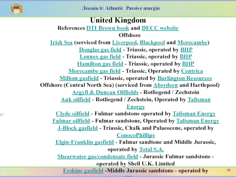
Offshore
Irish Sea (serviced from Liverpool, Blackpool and Morecambe)
Douglas gas field - Triassic, operated by BHP
Lennox gas field - Triassic, operated by BHP
Hamilton gas field - Triassic, operated by BHP
Morecambe gas field - Triassic, Operated by Centrica
Millom gasfield - Triassic, operated by Burlington Resources
Offshore (Central North Sea) (serviced from Aberdeen and Hartlepool)
Argyll & Duncan Oilfields - Rotliegend / Zechstein
Auk oilfield - Rotliegend / Zechstein, Operated by Talisman Energy
Clyde oilfield - Fulmar sandstone operated by Talisman Energy
Fulmar oilfield - Fulmar sandstone, Operated by Talisman Energy
J-Block gasfield - Triassic, Chalk and Palaeocene, operated by ConocoPhillips
Elgin-Franklin gasfield - Fulmar sandtone and Middle Jurassic, operated by Total S.A.
Shearwater gas/condensate field - Jurassic Fulmar sandstone - operated by Shell U.K. Limited
Erskine gasfield -Middle Jurassic sandstone - operated by Chevron
31
Слайд 38Лекція 6: Atlantic Passive margin
United Kingdom
References DTI Brown book and
DECC website
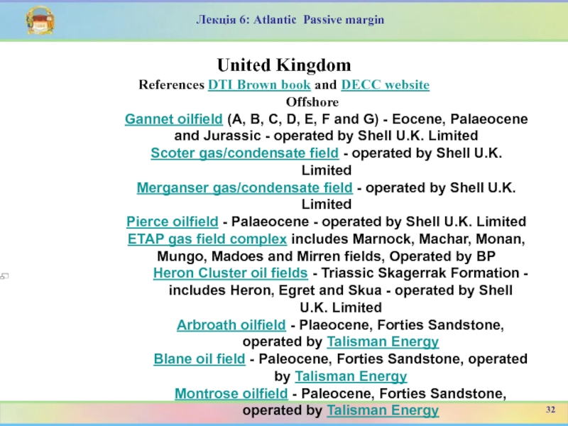
Offshore
Gannet oilfield (A, B, C, D, E, F
and G) - Eocene, Palaeocene and Jurassic - operated by Shell U.K. LimitedScoter gas/condensate field - operated by Shell U.K. Limited
Merganser gas/condensate field - operated by Shell U.K. Limited
Pierce oilfield - Palaeocene - operated by Shell U.K. Limited
ETAP gas field complex includes Marnock, Machar, Monan, Mungo, Madoes and Mirren fields, Operated by BP
Heron Cluster oil fields - Triassic Skagerrak Formation - includes Heron, Egret and Skua - operated by Shell U.K. Limited
Arbroath oilfield - Plaeocene, Forties Sandstone, operated by Talisman Energy
Blane oil field - Paleocene, Forties Sandstone, operated by Talisman Energy
Montrose oilfield - Paleocene, Forties Sandstone, operated by Talisman Energy
32
Слайд 39Лекція 6: Atlantic Passive margin
United Kingdom
References DTI Brown book and
DECC website
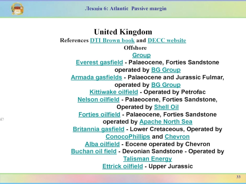
Offshore
Group
Everest gasfield - Palaeocene, Forties Sandstone operated by
BG GroupArmada gasfields - Palaeocene and Jurassic Fulmar, operated by BG Group
Kittiwake oilfield - Operated by Petrofac
Nelson oilfield - Palaeocene, Forties Sandstone, Operated by Shell Oil
Forties oilfield - Palaeocene, Forties Sandstone operated by Apache North Sea
Britannia gasfield - Lower Cretaceous, Operated by ConocoPhillips and Chevron
Alba oilfield - Eocene operated by Chevron
Buchan oil field - Devonian Sandstone - Operated by Talisman Energy
Ettrick oilfield - Upper Jurassic
33
Слайд 40Лекція 6: Atlantic Passive margin
United Kingdom
References DTI Brown book and
DECC website
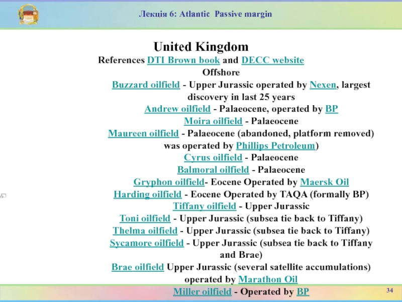
Offshore
Buzzard oilfield - Upper Jurassic operated by Nexen,
largest discovery in last 25 yearsAndrew oilfield - Palaeocene, operated by BP
Moira oilfield - Palaeocene
Maureen oilfield - Palaeocene (abandoned, platform removed) was operated by Phillips Petroleum)
Cyrus oilfield - Palaeocene
Balmoral oilfield - Palaeocene
Gryphon oilfield- Eocene Operated by Maersk Oil
Harding oilfield - Eocene Operated by TAQA (formally BP)
Tiffany oilfield - Upper Jurassic
Toni oilfield - Upper Jurassic (subsea tie back to Tiffany)
Thelma oilfield - Upper Jurassic (subsea tie back to Tiffany)
Sycamore oilfield - Upper Jurassic (subsea tie back to Tiffany and Brae)
Brae oilfield Upper Jurassic (several satellite accumulations) operated by Marathon Oil
Miller oilfield - Operated by BP
34
Слайд 41Лекція 6: Atlantic Passive margin
United Kingdom
References DTI Brown book and
DECC website
Offshore
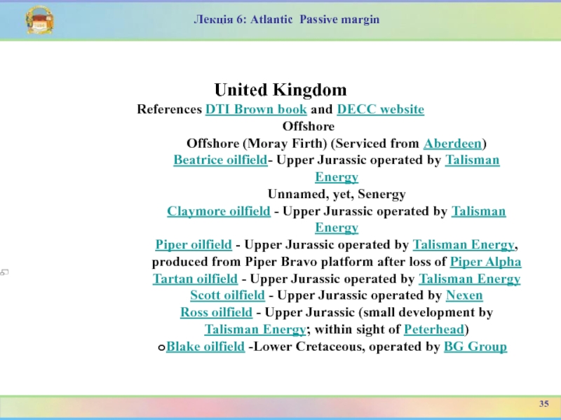
Offshore (Moray Firth) (Serviced from Aberdeen)
Beatrice oilfield-
Upper Jurassic operated by Talisman EnergyUnnamed, yet, Senergy
Claymore oilfield - Upper Jurassic operated by Talisman Energy
Piper oilfield - Upper Jurassic operated by Talisman Energy, produced from Piper Bravo platform after loss of Piper Alpha
Tartan oilfield - Upper Jurassic operated by Talisman Energy
Scott oilfield - Upper Jurassic operated by Nexen
Ross oilfield - Upper Jurassic (small development by Talisman Energy; within sight of Peterhead)
Blake oilfield -Lower Cretaceous, operated by BG Group
35
Слайд 42Лекція 6: Atlantic Passive margin
United Kingdom
References DTI Brown book and
DECC website
Offshore
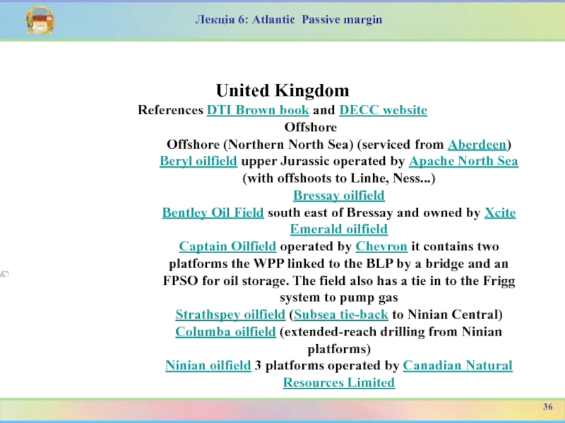
Offshore (Northern North Sea) (serviced from Aberdeen)
Beryl
oilfield upper Jurassic operated by Apache North Sea (with offshoots to Linhe, Ness...)Bressay oilfield
Bentley Oil Field south east of Bressay and owned by Xcite
Emerald oilfield
Captain Oilfield operated by Chevron it contains two platforms the WPP linked to the BLP by a bridge and an FPSO for oil storage. The field also has a tie in to the Frigg system to pump gas
Strathspey oilfield (Subsea tie-back to Ninian Central)
Columba oilfield (extended-reach drilling from Ninian platforms)
Ninian oilfield 3 platforms operated by Canadian Natural Resources Limited
36
Слайд 43Лекція 6: Atlantic Passive margin
United Kingdom
References DTI Brown book and
DECC website
Offshore
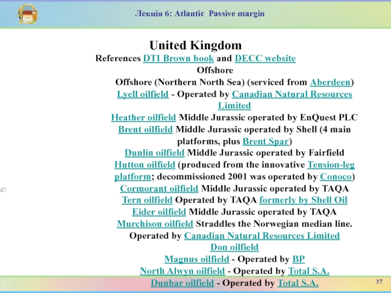
Offshore (Northern North Sea) (serviced from Aberdeen)
Lyell
oilfield - Operated by Canadian Natural Resources LimitedHeather oilfield Middle Jurassic operated by EnQuest PLC
Brent oilfield Middle Jurassic operated by Shell (4 main platforms, plus Brent Spar)
Dunlin oilfield Middle Jurassic operated by Fairfield
Hutton oilfield (produced from the innovative Tension-leg platform; decommissioned 2001 was operated by Conoco)
Cormorant oilfield Middle Jurassic operated by TAQA
Tern oilfield Operated by TAQA formerly by Shell Oil
Eider oilfield Middle Jurassic operated by TAQA
Murchison oilfield Straddles the Norwegian median line. Operated by Canadian Natural Resources Limited
Don oilfield
Magnus oilfield - Operated by BP
North Alwyn oilfield - Operated by Total S.A.
Dunbar oilfield - Operated by Total S.A.
37
Слайд 44Лекція 6: Atlantic Passive margin
United Kingdom
References DTI Brown book and
DECC website
Offshore
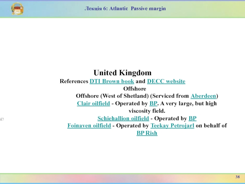
Offshore (West of Shetland) (Serviced from Aberdeen)
Clair
oilfield - Operated by BP. A very large, but high viscosity field.Schiehallion oilfield - Operated by BP
Foinaven oilfield - Operated by Teekay Petrojarl on behalf of BP Rish
38
Слайд 45Лекція 6: Atlantic Passive margin
Germany
Onshore
Wietze near Hanover, discovered in
1859.
The Schoenebeek field of the Netherlands extends across the border.
Offshore
Mittelplate, approx. 2 Mio m³/a of crude oil production
A6/B4, gas field 300 km in the North Sea, gas transport via the NOGAT pipeline
39
Слайд 46Лекція 6: Atlantic Passive margin
Denmark
Nothing onshore
Offshore development is abundant. Of
the 19 fields, 15 are operated by Maersk Oil and
Gas as part of the Dansk Undergrunds Consortium, with the remaining 4 operated by DONG Energy (3) and Hess (1).[1]Nils oilfiled
Skjold oilfield- Chalk reservoir
Gorm oil and gasfield - Chalk reservoir
Roar oilfield - Chalk reservoir
Harald oilfield - Chalk reservoir
Dan oil and gas field - Chalk reservoir
Kraka oilfield - Chalk reservoir
Halfdan oil and gas field - Chalk reservoir
Tyra oil and gas field - Chalk reservoir
40
Слайд 47Лекція 6: Atlantic Passive margin
Denmark
Nothing onshore
Offshore development is abundant.
Tyra
Southeast oil field
Svend oil field
Valdemar oilfield
Lulita gas field
Regnar oil field
Rolf
oil fieldDagmar oil field
Siri oil field
Nini oil field
Cecilie oil field
South Arne oil and gas field
41
Слайд 48Лекція 6: Atlantic Passive margin
Norway
Offshore developments. Serviced from Stavanger, Bergen,
Kristiansund
Central North Sea
Hod oilfield - Chalk reservoir, operated by
BPValhall oilfield - Chalk reservoir, operated by BP
Eldfisk - Chalk reservoir, operated by ConocoPhillips
Ekofisk - Chalk reservoir, operated by ConocoPhillips
Embla oilfield - Devonian / Permian Reservoir, operated by ConocoPhillips
Tor oilfield - Chalk reservoir, operated by ConocoPhillips
Albuskjell oilfield - decommissioned
Tambar oil field- Upper Jurassic sandstone reservoir, operated by BP
Ula oil field- Jurassic sandstone reservoir, operated by BP
Gyda oil field - Jurassic sandstone reservoir, operated by Talisman Energy
Blane oil field - Paleocene sandstone reservoir, operated by Talisman Energy
Oselvar oil field - operated by DONG Energy
Cod oilfield- decommissioned
42
Слайд 49Лекція 6: Atlantic Passive margin
Norway
Northern North Sea
Sleipner oilfield -
Jurassic and Palaeocene reservoirs, operated by Statoil
Brisling oilfield
Bream oilfield
Balder oilfield
- Palaeocene/Eocene, operated by ExxonMobilFrigg gas field Large Eocene reservoir gas field
Gudrun gas/oil field Jurassic reservoir, high pressure, being developed by Statoil
Hild gas field
Heimdal gas field - Palaeocene reservoir, operated by StatoilVale gas field - operated by Statoil
43
Слайд 50Лекція 6: Atlantic Passive margin
Norway
Oseberg oilfield Middle Jurassic sandstone reservoir
operated by Statoil
Grane oil field - operated by Statoil
Brage oil
field - operated by WintershallTroll Largest gas field in North Sea operated by Statoil.
Gullfaks oil field - Middle Jurassic reservoir operated by Statoil
Statfjord along strike from Brent, but structurally deeper, partially in UK sector. Operated by Statoil
Snorre oilfield - Middle Jurassic reservoir operated by Statoil
Marihøne oil field - operated in Partnership by Marathon Oil, Conoco Phillips and Lundin Petroleum
Murchison oil field (part of; produced through UK) operated by Canadian Natural Resources Limited
Agat
44
Слайд 52Лекція 6: Atlantic Passive margin
North Sea major projects and assets
46
The
Andrew platform (pictured) is going through a period of significant
investment and transformationСлайд 53Лекція 6: Atlantic Passive margin
North Sea major projects and assets
47
Major
projects
Clair Ridge
Operator: BP
Clair Ridge is a £4.5billion investment in the
second phase of development on the Clair field which lies 75km to the west of the Shetland Islands, extending over an area of 220km² in water depths of approximately 140 meters. The project will comprise two new bridge-linked platforms housing production, accommodation and drilling facilities, as well as new pipeline infrastructure to connect to processing facilities on Shetland. A LoSal® unit will be provided to increase oil recovery and provision will be made for future subsea tie-backs.Слайд 54Лекція 6: Atlantic Passive margin
North Sea major projects and assets
48
Kinnoull
Operator:
BP
Working Interest: 77%
The project consists of the development of the
Kinnoull reservoir along with pre-investment work to enable future development of the Arundel and Lower Cretaceous (LC) reservoirs. Kinnoull is 28 km northeast of the existing Andrew Platform in approximately 115 meters of water. The project consists of three subsea wells drilled as a single cluster. Tie back to the platform will be via a 28 km pipeline. Oil will be exported from the platform to the Forties Pipeline System and gas will be exported through the CATS system. Significant brownfield modifications to the Andrew platform include the addition of a 750 tonne process module, installation of a 220 tonne riser caisson, strengthening of the Andrew decks and associated tie-ins.
Слайд 55Лекція 6: Atlantic Passive margin
North Sea major projects and assets
49
Quad
204
Operator: BP
Working Interest: 36.3%
The Quad 204 project is a £3
billion development of the greater Schiehallion field area, comprising of a new floating production, storage and offloading (FPSO) vessel, new seabed infrastructure and utilising enhanced oil recovery technology. Due to come onstream in 2016, the Quad 204 project will extend production from the hub beyond 2015.The project is designed to produce 130 mbd of oil and 220 mmscfd of gas compression. Gas will be exported through sale to Magnus for Enhanced Oil Recovery purposes.
Слайд 56Лекція 6: Atlantic Passive margin
North Sea major projects and assets
50
Andrew
The
Andrew platform is going through a period of significant investment
and transformation that will result in it being one of the largest net producers in BP’s North Sea portfolio. Once the platform upgrade is complete and the Kinnoull reservoir connected, it will be an excellent example of how we can extend the life of a medium-sized asset and generate value. Extensive new subsea infrastructure, a new process module and structural strengthening of the platform will allow Andrew to produce for at least another decade.Bruce
Bruce was discovered in 1974 and still provides an important source of gas for the UK. Production commenced in 1993 from two platforms, with a further platform added later. The high-pressure, high-temperature Rhum gas field, which is tied back to Bruce, was brought into production in 2005. Production from Rhum was suspended in November 2010 to comply with EU sanctions against Iran. A restart of Rhum would enable the Bruce hub to remain viable and to continue producing beyond 2020.
Слайд 57Лекція 6: Atlantic Passive margin
North Sea major projects and assets
51
CATS
The
Central Area Transmission System (CATS) pipeline and terminal has a
significant part to play in the transportation and processing of central North Sea gas. It can transport up to 1.7 billion standard cubic feet of natural gas per day, which is equivalent to 20% of the UK’s demand. CATS has more than 20 third-party customers and transports gas from BP’s ETAP and Andrew facilities.Clair
Clair, the first fixed platform in the west of Shetland area, started producing in 2005. With an estimated eight billion barrels of oil in place, it is the largest oilfield in Europe. The field was discovered in 1977, but it was only with significant advances in technology and innovative engineering that the first phase of development was made possible. Clair Ridge, the £4.5 billion second phase of development, was confirmed in late 2011 and will see two new platforms installed and production starting in 2016. In 2013, a major appraisal drilling programme began to help define a possible third phase of development for Clair.
Слайд 58Лекція 6: Atlantic Passive margin
North Sea major projects and assets
52
ETAP
With
nine different reservoirs and a variety of field operators, the
Eastern Trough Area Project (ETAP) ranks as one of the largest and most commercially complex North Sea oil and gas developments of the past 20 years. BP is planning a major renewal programme for the field in the coming years. An accommodation ‘flotel’, to provide more bed space, will be deployed to allow long-term reliability, fabrication and new well work to be performed alongside near-term, production-adding work. BP sees significant potential and remaining field life in the ETAP asset – a reason why, in 2012, the company increased its equity share in the asset.Слайд 59Лекція 6: Atlantic Passive margin
North Sea major projects and assets
53
Foinaven
Foinaven
was the first deepwater oilfield to be developed in the
UK and was the first development field west of Shetland. It continues to be among BP North Sea’s top-producing fields. The pioneering fast-track development was based on a network of subsea wells linked to a floating, production, storage and offloading vessel, the Petrojarl Foinaven. A significant investment programme to renew and replace some of the subsea pipeline system was completed in 2012 and production is now due to continue beyond 2020. BP is reviewing the potential for accessing additional hydrocarbons in the area, to further extend the economic life of the hub and to ensure that Foinaven continues to produce for at least another decade.Слайд 60Лекція 6: Atlantic Passive margin
North Sea major projects and assets
54
Forties
Pipeline System
The Forties Pipeline System (FPS) serves more than 80
fields and more than 40 companies and has played a major role in the development of the central North Sea. Continued investment in technology and reliability, together with careful management of the facilities, has enabled FPS to remain the single most important piece of oil and gas infrastructure in the UK. The system brings almost 40% of the UK’s oil production to the mainland. The newly-commissioned enhanced gas separation project will provide further capability and flexibility to meet the needs of current and future customers, including Andrew and ETAP.Слайд 61Лекція 6: Atlantic Passive margin
North Sea major projects and assets
55
Magnus
Magnus
is BP’s oldest platform in the UK North Sea and,
despite its age, remains a key asset within the company’s portfolio. The field has achieved strong oil recovery through the longterm application of a water-alternating gas (WAG) enhanced oil recovery (EOR) scheme. As part of this scheme, Magnus imports a large proportion of BP’s produced west of Shetland gas – an innovative, strategically important connection. The current Magnus drilling programme (through to 2016) represents a significant commitment and is affirmation of the further value of the reservoir. Magnus will be the first platform to benefit from BP’s North Sea renewal programme, designed to extend the life of our mature assets, while improving reliability and creating capacity for production-related activities. The investment will enable Magnus to continue to deliver its reservoir potential into the future.Слайд 62Лекція 6: Atlantic Passive margin
It was obtained that oil-gas pools
are characterized by a lithosphere horizontal lamination and the existence
of intracrust layers with density and seismic wave velocity reduced.56
Слайд 63Лекція 6: Atlantic Passive margin
Hач. пром. запасы нефти 3729 млн.
т, газа 8411 млрд. м3, из них на шельфе соответственно
3430 млн. т и 5270 млрд. м3. Поисково-разведочные работы на суше проводятся c конца прошлого столетия (ФРГ), на шельфе геофиз. исследования проводятся c 1959. Первое нефт. м-ние на суше открыто в 1870 (Heнхаген, ФРГ, запасы 10 млн. т), на шельфе в 1967 (Дан, сектор Дании, запасы 30 млн. т). Первое газовое м-ние на суше открыто в 1944 (Эмлиххайм, ФРГ, запасы 5 млрд. м3), на шельфе в 1965 (Уэст-Cол, британский сектор, запасы 60 млрд. м3). Pазработка м-ний на шельфе Cев. моря начата в 1967. K 1986 открыто 211 нефт. и газонефт., 160 газовых и газоконденсатных м-ний, из них на шельфе соответственно 97 и 58. Hаиболее крупные м-ния: нефтяные - Брент (215 млн. т), Cтатфьорд (317 млн. т), Oзеберг (145 млн. т), Фортис (100 млн. т); газовые - Гронинген (1960 млрд. м3), Tролль (1287 млрд. м3), Леман (340 млрд. м3), Фригг (300 млрд. м3).56
Слайд 64На стадии зрелого океана осадочные бассейны в основном синхронны самому
океану (Атлантический и Индийский океаны). Осадочные бассейны предшествовавших этапов тектонического
развития либо разрушены в результате деструкции побережий океанов, либо ассимилированы вновь формирующимися осадочными бассейнами, одновозрастными океану.13
Лекція 2: Сучасні методи вивчення геології морів та океанів
Слайд 65Осадочные бассейны пассивных окраин Атлантического и Индийского океанов, как отмечалось,
несут следы унаследованности от более ранних этапов тектонического развития, хотя
в основном переработаны в процессе деструкции континентальных окраин и смещены в сторону континентального склона, захватывая иногда и ложе океана. Они частично сохраняют месторождения, отвечающие раннему этапу формирования окраин, и наращивают нефтегазовый потенциал за счет кайнозойского комплекса осадков. Большинство месторождений осадочных бассейнов Атлантической и Индийской континентальных окраин имеет двухъярусное строение, причем чаще всего скопления углеводородов приурочены к нижнему рифтогенному структурному этажу нефтегазоносности, хотя известны и в верхнем, позднемеловом – кайнозойском, комплексе осадков.18
Лекція 2: Сучасні методи вивчення геології морів та океанів
Слайд 66Лекція 1: Вступ до курсу
Гарецкий Р.Г. Эволюционные аспекты тектонических
процессов./Эволюция геологических процессов в истории Земли. – М. Наука, 1993.
-240 с.Хаин В.Е., Божко Н.А Историческая геотектоника: Докембрий. М.: недра, 1988, 382 с.
Хаин В.Е. Эволюция геологических обстановок в истории Земли./Эволюция геологических процессов в истории Земли. – М. Наука, 1993. -240 с.
Большаков В.А. Новая концепция орбитальной теории палеоклимата. М.: 2003, 256 с.
Плейстоценовые оледенения Восточно-Европейской равнины. -М."Наука",1986. -203 с.
31
3. Загальні гігієнічні вимоги до води, яка використовується людиною
СПИСОК РЕКОМЕНДОВАНОЇ ЛІТЕРАТУРИ

